Uruoca: Difference between revisions
Content deleted Content added
m r2.7.3) (Robot: Adding zh:Uruoca |
|||
| (12 intermediate revisions by 11 users not shown) | |||
| Line 1: | Line 1: | ||
{{Infobox settlement |
|||
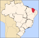
[[File:Ceara Municip Uruoca.svg|300px|thumb|right|Uruoca, within [[Ceará]], within [[Brazil]].]] |
|||
| official_name = Uruoca |
|||
| ⚫ | |||
| native_name = |
|||
| settlement_type = [[Municipalities of Brazil|Municipality]] |
|||
| image_shield = Brasao_de_uruoca.jpg |
|||
| image_flag = Bandeira_de_uruoca.jpg |
|||
| image_skyline = |
|||
| image_caption = |
|||
| image_map = Ceara Municip Uruoca.svg |
|||
| map_caption = Location in Ceará state |
|||
| pushpin_map = Brazil |
|||
| pushpin_map_caption = Location in Brazil |
|||
| ⚫ | |||
| subdivision_type = [[List of sovereign states|Country]] |
|||
| subdivision_name = Brazil |
|||
| subdivision_type1 = [[Regions of Brazil|Region]] |
|||
| subdivision_name1 = [[Northeast Region, Brazil|Northeast]] |
|||
| subdivision_type2 = [[States of Brazil|State]] |
|||
| subdivision_name2 = [[Ceará]] |
|||
| subdivision_type3 = [[Mesoregions of Brazil|Mesoregion]] |
|||
| subdivision_name3 = |
|||
| subdivision_type4 = [[Microregion (Brazil)|Microregion]] |
|||
| subdivision_name4 = |
|||
| subdivision_type5 = [[Metropolitan area#Brazil|Metrop. region]] |
|||
| subdivision_name5 = |
|||
| established_title = |
|||
| established_date = |
|||
| leader_party = |
|||
| leader_title = [[Mayor]] |
|||
| leader_name = |
|||
| elevation_m = |
|||
| area_footnotes = |
|||
| area_total_km2 = |
|||
| area_metro_km2 = |
|||
| population_footnotes = |
|||
| population_total = 13,915 |
|||
| population_as_of = 2020 <ref>[https://cidades.ibge.gov.br/brasil/ce/uruoca/panorama IBGE 2020]</ref> |
|||
| population_metro = |
|||
| population_density_km2 = auto |
|||
| population_demonym = |
|||
| blank_name_sec1 = [[Human Development Index|HDI]] |
|||
| blank_info_sec1 = |
|||
| timezone1 = [[Time in Brazil|BRT]] |
|||
| utc_offset1 = −3 |
|||
| timezone1_DST = |
|||
| utc_offset1_DST = |
|||
| postal_code_type = [[List of postal codes in Brazil|Postal code]] |
|||
| postal_code = |
|||
| area_code_type = [[List of dialling codes in Brazil|Area code]] |
|||
| area_code = |
|||
| website = |
|||
}} |
|||
| ⚫ | |||
The municipality contains part of the {{convert|1592550|ha}} [[Serra da Ibiapaba Environmental Protection Area]], created in 1996.<ref>{{citation|language=pt|ref={{harvid|APA Serra da Ibiapaba – ISA}} |
|||
| ⚫ | |||
|title=APA Serra da Ibiapaba|publisher=ISA: Instituto Socioambiental |
|||
|url=https://uc.socioambiental.org/uc/594860|access-date=2017-02-10}}</ref> |
|||
==References== |
|||
| ⚫ | |||
{{reflist}} |
|||
{{Municipalities of Ceará}} |
|||
| ⚫ | |||
| ⚫ | |||
| ⚫ | |||
[[es:Uruoca]] |
|||
[[bpy:উরুওকা]] |
|||
[[it:Uruoca]] |
|||
[[kk:Уруока]] |
|||
[[nl:Uruoca]] |
|||
[[no:Uruoca]] |
|||
[[pt:Uruoca]] |
|||
[[ro:Uruoca]] |
|||
[[ru:Уруока]] |
|||
[[vi:Uruoca]] |
|||
[[vo:Uruoca]] |
|||
[[war:Uruoca]] |
|||
[[zh:Uruoca]] |
|||
Latest revision as of 15:12, 25 July 2021
Uruoca | |
|---|---|
 Location in Ceará state | |
| Coordinates: 03°18′50″S 40°33′25″W / 3.31389°S 40.55694°W | |
| Country | Brazil |
| Region | Northeast |
| State | Ceará |
| Population (2020 [1]) | |
| • Total | 13,915 |
| Time zone | UTC−3 (BRT) |
Uruoca is a municipality of the Brazilian state of Ceará. Its estimated population is 13,915 inhabitants. It is part of the microregion of Coreaú, which is one of the seven microregions that make up the mesoregion of Noroeste Cearense.
The municipality contains part of the 1,592,550 hectares (3,935,300 acres) Serra da Ibiapaba Environmental Protection Area, created in 1996.[2]
References[edit]
- ^ IBGE 2020
- ^ APA Serra da Ibiapaba (in Portuguese), ISA: Instituto Socioambiental, retrieved 2017-02-10


