
Oddernes: Difference between revisions
→Shopping: promos sourced by perm. dead link mall directory Tags: references removed Visual edit |
|||
| (24 intermediate revisions by 11 users not shown) | |||
| Line 1: | Line 1: | ||
{{about|the borough in Kristiansand, Norway|the former municipality in Vest-Agder, Norway|Oddernes (municipality)}} |
|||
{{Infobox settlement |
{{Infobox settlement |
||
| |
|official_name = Oddernes |
||
|other_name = |
|||
|official_name = |
|||
| |
|native_name = |
||
|nickname = |
|nickname = |
||
|settlement_type = [[List of boroughs of Kristiansand|Borough]] of Kristiansand |
|settlement_type = [[List of boroughs of Kristiansand|Borough]] of Kristiansand |
||
|image_skyline = Varoddbrua.jpg |
|||
|total_type = <!-- to set a non-standard label for total area --> |
|||
| |
|image_caption = View of the [[Varodd Bridge]] |
||
|image_shield = Kristiansand komm.svg |
|||
<!-- images and maps --> |
|||
| |
|image_map = Oddernes-borough.png |
||
|map_caption = Location of Oddernes borough, shown in yellow. Districts: 18-Tveit, 17-Søm, 16-Hånes, 15-Randesund. |
|||
|imagesize =295px |
|||
|subdivision_type = Country |
|||
|image_caption = Varoddbrua form Vige to Søm |
|||
| |
|subdivision_name = [[Norway]] |
||
|subdivision_type1 = [[List of regions of Norway|Region]] |
|||
|flag_size = |
|||
|subdivision_name1 = [[Southern Norway]] |
|||
|image_seal = |
|||
|subdivision_type2 = [[Counties of Norway|County]] |
|||
|seal_size = |
|||
|subdivision_name2 = [[Agder]] |
|||
|image_shield = File:Kristiansand komm.svg |
|||
|subdivision_type3 = [[Districts of Norway|District]] |
|||
|shield_size = |
|||
|subdivision_name3 = [[Kristiansand Region|Kristiansand]] |
|||
|image_blank_emblem = |
|||
|subdivision_type4 = [[List of municipalities of Norway|City]] |
|||
|blank_emblem_type = |
|||
|subdivision_name4 = [[Kristiansand]] |
|||
|blank_emblem_size = |
|||
| |
|timezone1 = [[Central European Time|CET]] |
||
| |
|utc_offset1 = +01:00 |
||
|timezone1_DST = [[Central European Summer Time|CEST]] |
|||
|map_caption = Location of Oddernes, shown in yellow, in Kristiansand |
|||
|utc_offset1_DST = +02:00 |
|||
<!-- Location --> |
|||
|area_footnotes = |
|||
|coordinates_region = |
|||
|area_total_km2 = |
|||
|subdivision_type = [[List of sovereign states|Country]] |
|||
|population_as_of = 2015 |
|||
|subdivision_name = {{nowrap|{{flag|Norway}}}} |
|||
|population_footnotes = |
|||
|subdivision_type1 = [[Counties of Norway|County]] |
|||
|population_total = 19,800 |
|||
|subdivision_name1 = {{Coat of arms|Vest-Agder}} |
|||
|population_density_km2 = |
|||
|subdivision_type2 = |
|||
|postal_code_type = Post Code prefix |
|||
|subdivision_name2 = Vest-Agder |
|||
|postal_code = 460*, 462*, 463*, 465*, 477*, 469* |
|||
|subdivision_type3 = [[List of cities in Norway|City]] |
|||
|website = [http://www.kristiansand.kommune.no/ kristiansand.kommune.no] |
|||
|subdivision_name3 = [[Kristiansand]] |
|||
|coordinates = {{coord|58.1749|08.1076|region:NO_type:city|display=inline,title}} |
|||
<!-- Politics --> |
|||
|government_type = |
|||
|leader_title = |
|||
|leader_name = |
|||
|leader_title1 = |
|||
|leader_name1 = |
|||
|established_title = |
|||
|established_date = |
|||
|named_for = |
|||
|demonym = |
|||
<!-- Area --> |
|||
|area_total_sq_mi = |
|||
|area_land_sq_mi = |
|||
|area_water_sq_mi = |
|||
|unit_pref = imperial |
|||
<!-- Population --> |
|||
|population_as_of = 2015 |
|||
|population_total = 19,800 |
|||
|population_density_sq_mi = |
|||
|population_blank1_title = |
|||
|population_blank1 = |
|||
<!-- General information --> |
|||
|latd = |
|||
|latm = |
|||
|lats = |
|||
|latNS = |
|||
|longd = |
|||
|longm = |
|||
|longs = |
|||
|longEW = |
|||
<!-- Area/postal codes & others --> |
|||
|postal_code_type = [[ZIP Code]] prefix |
|||
|postal_code = 460*, 462*, 463*, 465*, 477*, 469* |
|||
|area_code = |
|||
|website = [http://ww.kristiansand.kommune.no/ kristiansand.kommune.no] |
|||
}} |
}} |
||
'''Oddernes''' is a |
'''Oddernes''' is a [[List of boroughs of Kristiansand|borough]] in the [[Kristiansand (town)|city of Kristiansand]] which lies in the municipality of [[Kristiansand]] in [[Agder]] county, [[Norway]]. The borough covers eastern Kristiansand on the east side of the [[Topdalsfjorden]] and the [[Varodd Bridge]]. The borough includes the former municipalities of [[Randesund (municipality)|Randesund]] and [[Tveit (municipality)|Tveit]]. There was a municipality of [[Oddernes (municipality)|Oddernes]] from 1838 until 1965, but its boundaries were very different from those of the present-day borough. |
||
==Name== |
==Name== |
||
The |
The borough (originally the [[prestegjeld|parish]]) is named after the old ''Oddernæs'' farm ([[Old Norse]]: ''Otruness''). The first part of the name comes from its location along the [[Otra]] river, and ''nes'' means [[headland|peninsula]], so the peninsula along the Otra river.<ref name="snl">{{cite web|publisher=[[Store norske leksikon]]|language=no|url=http://www.snl.no/Oddernes|title=Oddernes|access-date=2009-11-10}}</ref><ref>{{cite book|title=Norske gaardnavne: Lister og Mandals amt|edition=9|author-link=Oluf Rygh|last=Rygh|first=Oluf|publisher=W. C. Fabritius & sønners bogtrikkeri|year=1912|location=Kristiania, Norge|pages=9|url=http://www.dokpro.uio.no/perl/navnegransking/rygh_ng/rygh_bla.prl?enhid=141018&avid=31887|language=no}}</ref> |
||
== |
==Geography== |
||
===Districts and neighborhoods=== |
|||
The parish of ''Oddernæs'' was established as a municipality on 1 January 1838 (see [[formannskapsdistrikt]]). According to the 1835 census, the municipality had a population of 2,373.<ref>{{cite web|url=http://www.rhd.uit.no/dok/nos10.html|title=Hjemmehørende folkemengde Vest-Agder 1801-1960|author=Registreringssentral for historiske data|publisher=[[University of Tromsø]]|language=Norwegian}}</ref> On 31 December 1893, the area of [[Randesund]] was separated from Oddernes to contstitute a municipality of its own. The split left Oddernes with 3,076 inhabitants. |
|||
Oddernes borough is divided up into four districts. Each district is also divided up into neighborhoods. |
|||
On 1 July 1921, the area of Lund (population: 2,164) was moved from Oddernes to Kristiansand, constituting a new [[borough]] there. On 1 January 1965, the rest of Oddernes was incorporated into Kristiansand, along with the neighboring municipalities of Randesund and [[Tveit]]. Prior to the merger, Oddernes had a population of 18,668.<ref name=Dag>{{cite journal|first=Dag|last=Jukvam|publisher=[[Statistics Norway|Statistisk sentralbyrå]]|title=Historisk oversikt over endringer i kommune- og fylkesinndelingen|year=1999|format=PDF|url=http://www.ssb.no/emner/00/90/rapp_9913/rapp_9913.pdf|language=Norwegian}}</ref> |
|||
==Population and demographic== |
|||
{| class="wikitable sortable" |
{| class="wikitable sortable" |
||
|+ List of districts in Oddernes |
|+ List of districts in Oddernes |
||
|- |
|- |
||
! Nr !! District !! Population <ref>{{cite web|url=http://www.ssb.no/befolkning/artikler-og-publikasjoner/_attachment/182517?_ts=1469108bb18 |title=Befolkning i Kristiansand |publisher=ssb.no |date |
! Nr !! District !! Population <ref>{{cite web|url=http://www.ssb.no/befolkning/artikler-og-publikasjoner/_attachment/182517?_ts=1469108bb18 |title=Befolkning i Kristiansand |publisher=ssb.no |access-date=2014-01-01}}</ref> !! Map |
||
|- |
|- |
||
| 1 || [[Søm]] || 10,950 |
| 1 || [[Søm]] || 10,950 || [[File:Kristiansand-boroughs-som.png|100 px]] |
||
|- |
|- |
||
| 2 || [[Hånes]] || 4,200 |
| 2 || [[Hånes]] || 4,200 || [[File:Kristiansand-boroughs-hanes.png|100 px]] |
||
|- |
|- |
||
| 3 || [[Randesund]] || 2,900 |
| 3 || [[Randesund]] || 2,900 || [[File:Kristiansand-boroughs-randesund.png|100 px]] |
||
|- |
|- |
||
| 4 || [[Tveit]] || 1,880 |
| 4 || [[Tveit]] || 1,880 || [[File:Kristiansand-boroughs-tveit.png|100 px]] |
||
|} |
|} |
||
{| class="wikitable collapsible autocollapse sortable" |
|||
Neighborhoods in Oddernes: |
|||
!colspan=5|List of neighborhoods in Oddernes: |
|||
|- |
|||
{{columns-list | 5 | |
|||
| |
|||
*Bliksheia |
*Bliksheia |
||
*Bjørndalen |
*Bjørndalen |
||
| Line 110: | Line 75: | ||
*Eplehagen |
*Eplehagen |
||
*Fidje |
*Fidje |
||
| |
|||
*Fidjeåsen |
*Fidjeåsen |
||
*Foss |
*Foss |
||
| Line 122: | Line 88: | ||
*[[Haumyrheia]] |
*[[Haumyrheia]] |
||
*[[Holte (Kristiansand)|Holte]] |
*[[Holte (Kristiansand)|Holte]] |
||
| |
|||
*Hånestangen |
*Hånestangen |
||
*[[Hånni]] |
*[[Hånni]] |
||
| Line 134: | Line 101: | ||
*Moneheia |
*Moneheia |
||
*Nedre Hånes |
*Nedre Hånes |
||
| |
|||
*Nordlia |
*Nordlia |
||
*Odderhei |
*Odderhei |
||
| Line 146: | Line 114: | ||
*[[Strømme]] |
*[[Strømme]] |
||
*[[Strømsdalen]] |
*[[Strømsdalen]] |
||
| |
|||
*Sømskleiva |
*Sømskleiva |
||
*[[Sømslia]] |
*[[Sømslia]] |
||
| Line 158: | Line 127: | ||
*[[Vigvoll]] |
*[[Vigvoll]] |
||
*Vigvollåsen |
*Vigvollåsen |
||
| |
|} |
||
===Centrums=== |
|||
Strømme Centrum is the largest urban centre in Oddernes, it is located in Søm and is the centrum for Søm and Randesund. There is Regional Psychiatric Centre there along with other health stations. Randesund Police Station, which is a police station for Oddernes. [[Søm Church]] is located there along with Randesund Free Church. [[Randesund IL]] has their football stadium there, next to an indoor swimming pool. Strømme School is an elementary school located there. Østbyen Dagsenter is a retirement home. There is also two kindergartens in the centrum. |
|||
[[Hamresanden]] is a centrum for the district of [[Tveit]]. It has a fast-food restaurant, a grocery store, a gas station and local stores along with Tveit Free Church. |
|||
=== Photos === |
=== Photos === |
||
<gallery> |
<gallery mode="packed-hover" heights="90"> |
||
File:Hamre-5.jpg|Hamresanden Centrum |
|||
File:Hamre-1.jpg|Hamre |
File:Hamre-1.jpg|Hamre |
||
File:Holte1.jpg|Holte |
File:Holte1.jpg|Holte |
||
| Line 179: | Line 154: | ||
File:Torsvikkleiva.jpg|Torsvikkleiva |
File:Torsvikkleiva.jpg|Torsvikkleiva |
||
File:Nordlia4.jpg|Rødhettes vei |
File:Nordlia4.jpg|Rødhettes vei |
||
File:Fidjekilen3.jpg|Fidjekilen |
|||
File:Fijdekilen4.jpg|Fidjekilen |
File:Fijdekilen4.jpg|Fidjekilen |
||
File:Fidjekilen4.jpg|Fidjekilen harbor |
|||
File:Tømmerstø2.jpg|Tømmerstø with Morildveien |
|||
File:Tømmerstø.jpg|Tømmerstø with Dreggveien |
File:Tømmerstø.jpg|Tømmerstø with Dreggveien |
||
File:Tømmerstø1.jpg|Odderhei |
|||
File:Odderhei Terrasse.jpg|Odderhei Terrasse |
|||
</gallery> |
</gallery> |
||
==Education== |
==Education== |
||
[[File:Haumyrheia School.jpg|thumb|Haumyrheia Skole]] |
[[File:Haumyrheia School.jpg|thumb|Haumyrheia Skole]] |
||
{| class="wikitable sortable" |
{| class="wikitable collapsible autocollapse sortable" |
||
|+ List of schools in Oddernes |
|+ List of schools in Oddernes |
||
|- |
|- |
||
| Line 217: | Line 191: | ||
==Transportation== |
==Transportation== |
||
[[Kristiansand Airport, Kjevik]] is located at Tveit and is the main airport serving Kristiansand and [[Southern Norway]]. In 2014 there were around 1 million travelers. The airport is served with domestic routes to some of Norway's largest cities and international routes to European cities and some charter flights to southern Europe.<ref name= Avinor >{{cite web|publisher=[[Avinor]]|title=Avinor - Kristiansand Lufthavn, Kjevik|language=no|url=http://www.avinor.no/krs|access-date=2015-01-01}}</ref> |
|||
[[File:E 18 ved Kristiansand Dyrepark, Norge (mot øst).jpg|thumb|European route 18]] |
|||
[[File:Tømmerstø5.jpg|thumb|Norwegian County Road 3, Kystveien, with Tømmerstø]] |
|||
[[File:Kjevik-Hamresanden.jpg|thumb|Kjevik Airport seen from Hamresanden]] |
|||
[[File:Kristiansand .png|thumb|[[Varodd Bridge|Varoddbroa]] goes across [[Topdalsfjorden]] and is a part of [[European route E18|E18]]. It starts in Vige and ends in [[Søm]]]] |
|||
[[Kristiansand Airport, Kjevik]] is located at Tveit and is the main airport serving Kristiansand and [[Southern Norway]]. In 2014 there were around 1 million travelers. The airport is served with domestic routes to some of Norway's largest cities and international routes to European cities and some charter flights to southern Europe.<ref name= Avinor >{{cite web|publisher=[[Avinor]]|title=Avinor - Kristiansand Lufthavn, Kjevik|language=Norwegian|url=http://www.avinor.no/krs|accessdate=2015}}</ref> |
|||
[[European route E18]] is the main road and a highway, it goes through Oddernes from the neighbor municipality and county [[Lillesand]], [[Aust-Agder]]. E18 goes past the zoo and Sørlandsparken, then between Hånes and Søm before exiting the borough on the bridge [[Varoddbrua]] to Lund. [[Norwegian National Road 41]] comes from [[Birkenes]] municipality and enters Kristiansand north in Tveit. The road also connects to the airport and ends with E18 at Timenes. County road 401 goes from E18 at Rona and through Søm and Randesund before exiting Kristiansand to [[Høvåg]] in Lillesand. In Lillesand County road 401 meets the County road 420 witch stars with Sørlandsparken in Kristiansand and ends in [[Arendal]], Aust-Agder. County road 420 used to be the old E18 before the new one opened in 2009.<ref>{{cite web|url=http://www.vegvesen.no/|title=Statens Vegvesen |publisher=vegvesen.no |date |
[[European route E18]] is the main road and a highway, it goes through Oddernes from the neighbor municipality and county [[Lillesand]], [[Aust-Agder]]. E18 goes past the zoo and Sørlandsparken, then between Hånes and Søm before exiting the borough on the bridge [[Varoddbrua]] to Lund. [[Norwegian National Road 41]] comes from [[Birkenes]] municipality and enters Kristiansand north in Tveit. The road also connects to the airport and ends with E18 at Timenes. County road 401 goes from E18 at Rona and through Søm and Randesund before exiting Kristiansand to [[Høvåg]] in Lillesand. In Lillesand County road 401 meets the County road 420 witch stars with Sørlandsparken in Kristiansand and ends in [[Arendal]], Aust-Agder. County road 420 used to be the old E18 before the new one opened in 2009.<ref>{{cite web|url=http://www.vegvesen.no/|title=Statens Vegvesen |publisher=vegvesen.no |access-date=2015-01-01}}</ref> |
||
{| class="wikitable sortable" |
{| class="wikitable sortable collapsible autocollapse" |
||
|+ List of notable roads in Oddernes |
|+ List of notable roads in Oddernes |
||
|- |
|- |
||
| Line 250: | Line 220: | ||
| Fv453 || [[Ålefjær]] - Ryen |
| Fv453 || [[Ålefjær]] - Ryen |
||
|} |
|} |
||
<gallery mode="packed-hover" heights="90"> |
|||
File:E 18 ved Kristiansand Dyrepark, Norge (mot øst).jpg|European route 18 |
|||
File:Tømmerstø5.jpg|Norwegian County Road 3, Kystveien, with Tømmerstø |
|||
File:Kjevik-Hamresanden.jpg|Kjevik Airport seen from Hamresanden |
|||
File:Nettbuss Sør Kristiansand.JPG|A bus downtown on its way to Søm |
|||
File:Mb öya 1955 IMG 5223 randesund kristiansand.JPG|Public ferry in Randesund |
|||
</gallery> |
|||
Buses in Oddernes is mostly served by routes 01, M1, M2, M3, 17, 18, 35, 36, 37, 100 and 139. These routes goes all day and extra in the rush hours, while the others goes only to certain times. Regional buses to [[Oslo]] stops at one stop in Oddernes, Håneskrysset, before continuing. |
Buses in Oddernes is mostly served by routes 01, M1, M2, M3, 17, 18, 35, 36, 37, 100 and 139. These routes goes all day and extra in the rush hours, while the others goes only to certain times. Regional buses to [[Oslo]] stops at one stop in Oddernes, Håneskrysset, before continuing. |
||
{| class="wikitable collapsible autocollapse sortable" |
|||
[[File:Nettbuss Sør Kristiansand.JPG|thumb|A bus downtown on its way to Søm]] |
|||
[[File:Mb öya 1955 IMG 5223 randesund kristiansand.JPG|thumb|Public ferry in Randesund]] |
|||
{| class="wikitable sortable" |
|||
|+ Local bus transportation from/through Oddernes |
|+ Local bus transportation from/through Oddernes |
||
|- |
|- |
||
! Line !! Destination <ref>{{cite web|url=http://www.akt.no|title |
! Line !! Destination <ref>{{cite web|url=http://www.akt.no|title=AKT|access-date=2020-04-23|archive-url=https://web.archive.org/web/20190725171322/https://akt.no/|archive-date=2019-07-25|url-status=dead}}</ref> |
||
|- |
|- |
||
| 01 || [[Sørlandsparken]] - [[Kvadraturen (Kristiansand)|Kvadraturen]] |
| 01 || [[Sørlandsparken]] - [[Kvadraturen (Kristiansand)|Kvadraturen]] |
||
| Line 331: | Line 307: | ||
==Tourism== |
==Tourism== |
||
[[File:Kardemomme by.jpg|thumb|Kardemommeby in Kristiansand Zoo and Amusement Park]] |
[[File:Kardemomme by.jpg|thumb|Kardemommeby in Kristiansand Zoo and Amusement Park]] |
||
[[Kristiansand Zoo and Amusement Park]] is the largest zoo in Norway and the second most visited tourist attraction in Norway after Holmenkollen, Oslo. The park also includes a tivoli and a waterpark. There are some hotels located in the area for visitors. Abrahavn is a resort in the zoo.<ref name= Dyreparken >{{cite web|publisher=[[Kristiansand Zoo and Amusement Park]]|title=Kristiansand Dyrepark|language= |
[[Kristiansand Zoo and Amusement Park]] is the largest zoo in Norway and the second most visited tourist attraction in Norway after Holmenkollen, Oslo. The park also includes a tivoli and a waterpark. There are some hotels located in the area for visitors. Abrahavn is a resort in the zoo.<ref name= Dyreparken >{{cite web|publisher=[[Kristiansand Zoo and Amusement Park]]|title=Kristiansand Dyrepark|language=no|url=http://dyreparken.no/|access-date=2015-01-01}}</ref> |
||
Randesund is a popular vacation area with a lot of cabins for rent at small islands or on the mainland. |
|||
[[File:Hamresanden.png|thumb|Hamresanden Beach]] |
[[File:Hamresanden.png|thumb|Hamresanden Beach]] |
||
Hamresanden camping is a popular camping place with the beach. There is also a bible camp there. |
Randesund is a popular vacation area with a lot of cabins for rent at small islands or on the mainland. Hamresanden camping is a popular camping place with the beach. There is also a bible camp there. Kristiansand Travpark is a racetrack located between the zoo and Sørlandsparken. |
||
Kristiansand Travpark is a racetrack located between the zoo and Sørlandsparken. |
|||
==Shopping== |
==Shopping== |
||
[[Sørlandsparken]] is located in Oddernes. The industrial shopping park includes Norway's largest mall '''Sørlandssenteret''' with over 195 stores. |
[[Sørlandsparken]] is located in Oddernes. The industrial shopping park includes Norway's largest mall '''Sørlandssenteret''' with over 195 stores. |
||
Rona Mall is a local mall located at Rona, Søm. The mall includes a fitness center, dentist, pharmacy, grocery store and a hair salon. On top of the mall, there is apartments. Rona Mall is located off the highway E18 and besides County Road 401. |
Rona Mall is a local mall located at Rona, Søm. The mall includes a fitness center, dentist, pharmacy, grocery store and a hair salon. On top of the mall, there is apartments. Rona Mall is located off the highway E18 and besides County Road 401. |
||
| Line 349: | Line 322: | ||
=== Photos === |
=== Photos === |
||
<gallery> |
<gallery mode="packed-hover" heights="90"> |
||
File:Sørlandssenteret5.jpg|Sørlandssenteret |
File:Sørlandssenteret5.jpg|Sørlandssenteret |
||
File:Rona senter-2.jpg|Rona Mall |
File:Rona senter-2.jpg|Rona Mall |
||
File:Lauvåsen senter.jpg|Lauvåsen Mall |
File:Lauvåsen senter.jpg|Lauvåsen Mall |
||
</gallery> |
</gallery> |
||
== Centrums == |
|||
[[File:Hamre-5.jpg|thumb|Hamresanden Centrum]] |
|||
Strømme Centrum is the largest centrum in Oddernes, it is located in Søm and is the centrum for Søm and Randesund. There is Regional Psychiatric Centre there along with other health stations. Randesund Police Station, which is a police station for Oddernes. Søm Church is located there along with Randesund Free Church. [[Randesund IL]] has their football stadium there, next to an indoor swimming pool. Strømme School is an elementary school located there. Østbyen Dagsenter is an retirement home. There is also two kindergartens in the centrum. |
|||
[[Hamresanden]] is a centrum for the district of Tveit. It has a fast-food restaurant, a grocery store, a gas station and local stores along with Tveit Free Church. |
|||
==Religion== |
==Religion== |
||
There are four churches in Oddernes. In Randesund, [[Randesund Church]] was built in 1864, it has a capacity of 450 people and is located at Frikstad. The church is built out of tree and there is a graveyard with the church. [[Søm Church]] was built in 2004. The windows was designed by Kjell Nupen and has a capacity of 400 people. The church was Kristiansand's "Thousand years building" since the construction started in the new millennium (Year 2000). |
|||
There are 4 churches in Oddernes. |
|||
[[Hånes Church]] was built in 1986, it has the capacity of 300 people and built by bricks, there is no graveyard with Hånes church. [[Tveit Church (Vest-Agder)|Tveit Church]] is the oldest church in Oddernes, it was built in 1100 by stone. In 1831, a tower was built on the top of the church and in 1867 a restaurant was built in the church. Tveit church has a capacity of 450 people, there is a graveyard with the church and it is a nave church. The church is located with Ryen of Norwegian National Road 41. |
|||
[[Oddernes Church]] is not located in the Oddernes borough, but in the neighboring [[Lund (Kristiansand)|Lund]] borough with the [[UiA|University]]. The reason is that Lund was a part of the Oddernes municipality before it became a part of Kristiansand, and since then the borders of the boroughs have been re-drawn. |
|||
[[Søm Church]] was built in 2004. The windows was designed by Kjell Nupen and has a capacity of 400 people. The church was Kristiansand's "Thousand years building" since the construction started in the new millennium (Year 2000). |
|||
[[Hånes Church]] was built in 1986, it has the capacity of 300 people and built by bricks, there is no graveyard with Hånes church. |
|||
[[Tveit Church]] is the oldest church in Oddernes, it was built in 1100 by stone. In 1831, a tower was built on the top of the church and in 1867 a restaurant was built in the church. Tveit church has a capacity of 450 people, there is a graveyard with the church and it is a nave church. The church is located with Ryen of Norwegian National Road 41. |
|||
[[Oddernes Church]] itself is not located in the Oddernes but in the [[Lund, Kristiansand|Lund]] borough with the [[UiA|University]]. The reason is that Lund was a part of the Oddernes municipality before it became a part of Kristiansand. |
|||
=== Photos === |
=== Photos === |
||
<gallery> |
<gallery mode="packed-hover" heights="90"> |
||
File:Oddernes kirke B.JPG|Oddernes Church which is located at Lund |
File:Oddernes kirke B.JPG|Oddernes Church which is located at Lund |
||
File:Randesund kirke 001.JPG|Randesund Church |
File:Randesund kirke 001.JPG|Randesund Church |
||
| Line 384: | Line 344: | ||
</gallery> |
</gallery> |
||
== Society |
== Society and environment == |
||
[[File:Skippergada.jpg|thumb|Skippergada is a maritime natural canal in Randøya]] |
[[File:Skippergada.jpg|thumb|Skippergada is a maritime natural canal in Randøya]] |
||
Oddernes mostly consists of neighborhoods and farms. The Tveit area and large parts of Randesund are more agricultural, while the districts of Søm and Hånes and the neighborhoods of Tømmerstø and Hamresanden are all in the urban zone. |
|||
[[File:Søm-3.jpg|thumb|View of Søm from [[Marvika]]]] |
|||
Randesund includes large parts of the [[Southern Norway]] [[archipelago]]. It is also popular to have a cottage on the shore of Randesund. Populated islands off the shore of Randesund are Herøya and Randøya. Tømmerstø, Rabbesvik, Holte, Odderhei and Dvergsnes all fall within the part of Randesund known as Tømmerstø. This part of Randesund consists of typical Norwegian neighborhoods, but with a bit larger houses and has been criticized as an upper-middle-class neighborhood, especially Dvergsnes. Aside from the suburban areas in Tømmerstø, Randesund is mostly agricultural as one approaches [[Lillesand]]. Randesund has 2,000 people, of whom 7% come from a non-Norwegian background, the lowest percentagein Kristiansand and second to last on the list of most populated immigrant places in Kristiansand after [[Gimlekollen]] and before [[Flekkerøy]]. |
|||
Oddernes is mostly consist of neighborhoods and farms. While Tveit and large parts of Randesund is more agricultural, the districts Søm, Hånes and neighborhoods Tømmerstø and Hamresanden is in the urban zone and neighborhoods in the town Kristiansand. |
|||
Søm mostly consists of neighborhoods from the 1970s. Søm only has 10% non-Norwegian citizens and is one of the areas in Kristiansand with the lowest percentage of immigrants, despite being the most populated part of Oddernes with 9,000 people. Søm is a typical urban neighborhood of a city. |
|||
Randesund has large parts of the [[Southern Norway]]'s [[archipelago]]. It is also popular to have cottage in the shore of Randesund. Populated island in the shore of Randesund is Herøya and Randøya. Tømmerstø, Rabbesvik, Holte, Odderhei and Dvergsnes all goes under the part of Randesund known as Tømmerstø. This part of Randesund consist of typical Norwegian neighborhoods, but with a bit larger houses and has been criticized as an upper-middle-class neighborhood, especially Dvergsnes. Besides from the suburban areas in Tømmerstø, the rest of Randesund is mostly agriculture as closer you get to [[Lillesand]]. Randesund has 2,000 people where 7% comes from a non-Norwegian background, it is the lowest percent in Kristiansand and Randesund is the second last on the list of most populated immigrant places in Kristiansand after [[Gimlekollen]] and before [[Flekkerøy]]. |
|||
Hånes also mostly consist of neighborhoods. Some of Norway's most expensive properties were sold on Hånestangen. Other than that, Hånes has a wide range of apartment buildings and typical Norwegian neighborhoods. Hånes has a population of 4,000 of whom 18% come from a non-Norwegian background, meaning Hånes is the place in Oddernes with most immigrants, and the sixth most popular place for immigrants in Kristiansand after [[Tinnheia]]. |
|||
Søm mostly consist of neighborhoods from all the way back to the 1970s when they started building out and was especially promoted the view of the city you got from the west side of Søm. Søm is today still building out large neighborhoods and has been criticized for being a very religious area in [[Christianity]]. Søm only has 10% non-Norwegian citizens and it's one of the parts in Kristiansand with lowest percent in immigration. Søm is however the most populated part of Oddernes with 9,000 people. Søm is a typical urban neighborhood of a city. |
|||
Tveit is the largest part of the borough by area, but it also has the smallest population of only about 1,000 people. Tveit is home to most of the farms in Kristiansand and only a few residential neighborhoods like Hamresanden, Brattvollsheia, and Solsletta. |
|||
Hånes also mostly consist of neighborhoods. Some of Norway's most expensive properties was sold on Hånestangen. Other than that, Hånes has a wide range of apartment buildings and typical Norwegian neighborhoods. Hånes has a population of 4,000 and where 18% comes from an non-Norwegian background. Meaning Hånes is the place in Oddernes with most immigrants, and the 6th most popular place for immigrants in Kristiansand after [[Tinnheia]]. |
|||
===Photos=== |
|||
Tveit is the largest part with the smallest population of only 1,000. Tveit consist of most farms in Kristiansand and a few neighborhoods like Hamresanden, Brattvollsheia and Solsletta. |
|||
<gallery mode="packed-hover" heights="90"> |
|||
Fidjekilen Harbor1.jpg|Fidjekilen Harbor in Tømmerstø |
|||
== Old Oddernes == |
|||
Tveit-8.JPG|Farms at Tveit |
|||
Until 1965, Oddernes was its own municipality, but so was Randesund and Tveit. So Oddernes wasn't exactly located as it is today. In fact only the part Hånes was a part of Oddernes from the parts of Oddernes today. Other places in Kristiansand that was a part of Oddernes was the entire Vågsbygd borough (except [[Voiebyen]]), Hellemyr, Strai, Mosby, Lund and Justvik. Oddernes Church is located at Lund and still has the same name today. While Oddernes High School, located in [[Vågsbygd sentrum|Vågsbygd Centrum]] changed the name to [[Vågsbygd High School]]. |
|||
Søm-3.jpg|View of Søm from [[Marvika]] |
|||
Søm, Kristiansand.jpg|Søm seen from [[Marvika]] |
|||
</gallery> |
|||
==See also== |
==See also== |
||
| Line 414: | Line 377: | ||
{{Kristiansand}} |
{{Kristiansand}} |
||
[[Category:Former municipalities of Norway]] |
|||
[[Category:Geography of Kristiansand]] |
[[Category:Geography of Kristiansand]] |
||
[[Category:Boroughs of Kristiansand]] |
[[Category:Boroughs of Kristiansand]] |
||
Latest revision as of 18:47, 7 April 2024
Oddernes | |
|---|---|
Borough of Kristiansand | |
 View of the Varodd Bridge | |
 Coat of arms | |
 Location of Oddernes borough, shown in yellow. Districts: 18-Tveit, 17-Søm, 16-Hånes, 15-Randesund. | |
| Coordinates: 58°10′30″N 8°06′27″E / 58.1749°N 08.1076°E | |
| Country | Norway |
| Region | Southern Norway |
| County | Agder |
| District | Kristiansand |
| City | Kristiansand |
| Population (2015) | |
| • Total | 19,800 |
| Time zone | UTC+01:00 (CET) |
| • Summer (DST) | UTC+02:00 (CEST) |
| Post Code prefix | 460*, 462*, 463*, 465*, 477*, 469* |
| Website | kristiansand.kommune.no |
Oddernes is a borough in the city of Kristiansand which lies in the municipality of Kristiansand in Agder county, Norway. The borough covers eastern Kristiansand on the east side of the Topdalsfjorden and the Varodd Bridge. The borough includes the former municipalities of Randesund and Tveit. There was a municipality of Oddernes from 1838 until 1965, but its boundaries were very different from those of the present-day borough.
Name[edit]
The borough (originally the parish) is named after the old Oddernæs farm (Old Norse: Otruness). The first part of the name comes from its location along the Otra river, and nes means peninsula, so the peninsula along the Otra river.[1][2]
Geography[edit]
Districts and neighborhoods[edit]
Oddernes borough is divided up into four districts. Each district is also divided up into neighborhoods.
| Nr | District | Population [3] | Map |
|---|---|---|---|
| 1 | Søm | 10,950 | 
|
| 2 | Hånes | 4,200 | 
|
| 3 | Randesund | 2,900 | 
|
| 4 | Tveit | 1,880 | 
|
| List of neighborhoods in Oddernes: | ||||
|---|---|---|---|---|
|
|
|
||
Centrums[edit]
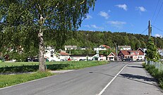
Strømme Centrum is the largest urban centre in Oddernes, it is located in Søm and is the centrum for Søm and Randesund. There is Regional Psychiatric Centre there along with other health stations. Randesund Police Station, which is a police station for Oddernes. Søm Church is located there along with Randesund Free Church. Randesund IL has their football stadium there, next to an indoor swimming pool. Strømme School is an elementary school located there. Østbyen Dagsenter is a retirement home. There is also two kindergartens in the centrum.
Hamresanden is a centrum for the district of Tveit. It has a fast-food restaurant, a grocery store, a gas station and local stores along with Tveit Free Church.
Photos[edit]
-
 Hamresanden Centrum
 -
 Hamre
Hamre -
 Holte
Holte -
 Holte
Holte -
 Hånni
Hånni -
 Lauvåsen
 -
 Nordlia
 -
 Rabbesvik
 -
 Ryen
Ryen -
 Solsletta
 -
 Småslettene
 -
 Strømsdalen
 -
 Ve
Ve -
 Vigvollåsen
 -
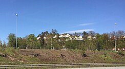
 Nordlia
 -
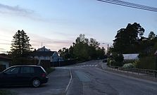
 Torsvik
 -
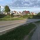
 Torsvikkleiva
 -
 Rødhettes vei
 -
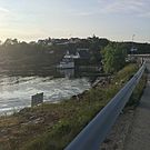 Fidjekilen
 -
 Tømmerstø with Dreggveien
 -
 Odderhei
 -
 Odderhei Terrasse


Education[edit]

| Name | Location | Type [4] |
|---|---|---|
| Dvergsnes skole | Dvergsnes | Elementary school |
| Haumyrheia skole | Søm | Junior High |
| Heståsen skole | Hånes | Elementary |
| Holte skole | Tømmerstø | Elementary |
| Hånes skole | Hånes | Elementary |
| Kringsjå skole | Randesund | Elementary |
| Strømme skole | Strømme | Elementary |
| Sørlandet Maritime videregående | Tømmerstø | High School |
| Vardåsen skole | Søm | Elementary |
| Ve skole | Tveit | Elementary and Junior High |
| Vigvoll skole | Vigvoll | Junior High |
Transportation[edit]
Kristiansand Airport, Kjevik is located at Tveit and is the main airport serving Kristiansand and Southern Norway. In 2014 there were around 1 million travelers. The airport is served with domestic routes to some of Norway's largest cities and international routes to European cities and some charter flights to southern Europe.[5]
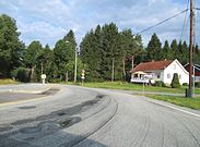
European route E18 is the main road and a highway, it goes through Oddernes from the neighbor municipality and county Lillesand, Aust-Agder. E18 goes past the zoo and Sørlandsparken, then between Hånes and Søm before exiting the borough on the bridge Varoddbrua to Lund. Norwegian National Road 41 comes from Birkenes municipality and enters Kristiansand north in Tveit. The road also connects to the airport and ends with E18 at Timenes. County road 401 goes from E18 at Rona and through Søm and Randesund before exiting Kristiansand to Høvåg in Lillesand. In Lillesand County road 401 meets the County road 420 witch stars with Sørlandsparken in Kristiansand and ends in Arendal, Aust-Agder. County road 420 used to be the old E18 before the new one opened in 2009.[6]
| Route | Destination |
|---|---|
| E18 | Oslo - Sørlandsparken - Haumyrheia - Downtown |
| Rv41 | Birkeland - Timenes |
| Rv451 | Kristiansand Airport, Kjevik - Kjevik |
| Fv3 | Søm - Frikstad - Drangestrand |
| Fv4 | Tømmerstø - Kongshaven |
| Fv10 | Strømme - Korsvik |
| Fv11 | Holte - Frikstad |
| Fv401 | Rona - Randesund |
| Fv420 | Arendal - Lillesand - Sørlandsparken |
| Fv453 | Ålefjær - Ryen |
-
 European route 18
 -
 Norwegian County Road 3, Kystveien, with Tømmerstø
 -
 Kjevik Airport seen from Hamresanden
 -
 A bus downtown on its way to Søm
 -
 Public ferry in Randesund
.jpg)


Buses in Oddernes is mostly served by routes 01, M1, M2, M3, 17, 18, 35, 36, 37, 100 and 139. These routes goes all day and extra in the rush hours, while the others goes only to certain times. Regional buses to Oslo stops at one stop in Oddernes, Håneskrysset, before continuing.
| Line | Destination [7] |
|---|---|
| 01 | Sørlandsparken - Kvadraturen |
| M1 | Sørlandsparken-Dyreparken IKEA - Flekkerøy |
| A1 | Sørlandsparken - Kvadraturen |
| A2 | Hånes - Kvadraturen |
| A3 | Søm - Kvadraturen |
| A24 | Skibåsen - Kvadraturen |
| A26 | Sørlandsparken - Voiebyen |
| M2 | Hånes - Voiebyen |
| M2 | Hånes - Kvadraturen |
| M2 | Sørlandssenteret - Lauvåsen - Hånes - Voiebyen |
| M2 | Hånes / Kjevik-Tveit - Voiebyen |
| N2 | Hånes - Lund - Kvadraturen |
| N3 | Søm - Slettheia |
| N17 | Tømmerstø - Kvadraturen |
| M3 | Søm - Slettheia |
| N3 | Søm - Slettheia |
| 08 | Rona - Randesund |
| 17 | Tømmerstø - Hellemyr |
| 17 | Tømmerstø-Frikstad - Hellemyr |
| 18 | Tømmerstø Odderhei-Holte - Hellemyr |
| 18 | Dvergsnes - Hellemyr |
| A18 | Tømmerstø Odderhei-Holte - Eg-Sykehuset |
| 35 | Kristiansand - Kjevik-Brattvollsheia |
| 35 | Kristiansand - Kjevik-Brattvollsheia / Grødum |
| 35 | Rona - Kjevik-Tveit |
| 36 | Kristiansand - Tveit-Grødum |
| 36 | Ve - Tveit-Grødum |
| 37 | Kristiansand - Birkeland |
| 37 | Kristiansand - Birkeland om Dønnestad |
| 100 | Kristiansand - Lillesand - Grimstad - Arendal |
| 139 | Høvåg-Lillesand - Kristiansand |
| 220 | Ve - Solsletta-Grødum-Dønnestad |
| 266 | Søm - Kristiansand Cathedral School |
| 900 | Farsund-Mandal - Kristiansand - Kjevik |
Tourism[edit]

Kristiansand Zoo and Amusement Park is the largest zoo in Norway and the second most visited tourist attraction in Norway after Holmenkollen, Oslo. The park also includes a tivoli and a waterpark. There are some hotels located in the area for visitors. Abrahavn is a resort in the zoo.[8]

Randesund is a popular vacation area with a lot of cabins for rent at small islands or on the mainland. Hamresanden camping is a popular camping place with the beach. There is also a bible camp there. Kristiansand Travpark is a racetrack located between the zoo and Sørlandsparken.
Shopping[edit]
Sørlandsparken is located in Oddernes. The industrial shopping park includes Norway's largest mall Sørlandssenteret with over 195 stores.
Rona Mall is a local mall located at Rona, Søm. The mall includes a fitness center, dentist, pharmacy, grocery store and a hair salon. On top of the mall, there is apartments. Rona Mall is located off the highway E18 and besides County Road 401.
Hånes Mall is a small local mall for the neighborhoods at Hånes, it is a part of an apartment building and has a grocery store and a hair salon. Hånes Mall is located in the neighborhood Vigvoll.
Lauvåsen Mall is a mall with a fitness center and hair salon. It is located off Norwegian National Road 41 between Grovikheia and Landauvåsen.
Photos[edit]
-
 Sørlandssenteret
 -
 Rona Mall
 -
 Lauvåsen Mall


Religion[edit]
There are four churches in Oddernes. In Randesund, Randesund Church was built in 1864, it has a capacity of 450 people and is located at Frikstad. The church is built out of tree and there is a graveyard with the church. Søm Church was built in 2004. The windows was designed by Kjell Nupen and has a capacity of 400 people. The church was Kristiansand's "Thousand years building" since the construction started in the new millennium (Year 2000).
Hånes Church was built in 1986, it has the capacity of 300 people and built by bricks, there is no graveyard with Hånes church. Tveit Church is the oldest church in Oddernes, it was built in 1100 by stone. In 1831, a tower was built on the top of the church and in 1867 a restaurant was built in the church. Tveit church has a capacity of 450 people, there is a graveyard with the church and it is a nave church. The church is located with Ryen of Norwegian National Road 41.
Oddernes Church is not located in the Oddernes borough, but in the neighboring Lund borough with the University. The reason is that Lund was a part of the Oddernes municipality before it became a part of Kristiansand, and since then the borders of the boroughs have been re-drawn.
Photos[edit]
-
 Oddernes Church which is located at Lund
 -
 Randesund Church
 -
 Søm Church
 -
 Hånes Free Church
 -
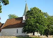 Tveit Church


Society and environment[edit]

Oddernes mostly consists of neighborhoods and farms. The Tveit area and large parts of Randesund are more agricultural, while the districts of Søm and Hånes and the neighborhoods of Tømmerstø and Hamresanden are all in the urban zone.
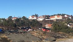
Randesund includes large parts of the Southern Norway archipelago. It is also popular to have a cottage on the shore of Randesund. Populated islands off the shore of Randesund are Herøya and Randøya. Tømmerstø, Rabbesvik, Holte, Odderhei and Dvergsnes all fall within the part of Randesund known as Tømmerstø. This part of Randesund consists of typical Norwegian neighborhoods, but with a bit larger houses and has been criticized as an upper-middle-class neighborhood, especially Dvergsnes. Aside from the suburban areas in Tømmerstø, Randesund is mostly agricultural as one approaches Lillesand. Randesund has 2,000 people, of whom 7% come from a non-Norwegian background, the lowest percentagein Kristiansand and second to last on the list of most populated immigrant places in Kristiansand after Gimlekollen and before Flekkerøy.
Søm mostly consists of neighborhoods from the 1970s. Søm only has 10% non-Norwegian citizens and is one of the areas in Kristiansand with the lowest percentage of immigrants, despite being the most populated part of Oddernes with 9,000 people. Søm is a typical urban neighborhood of a city.
Hånes also mostly consist of neighborhoods. Some of Norway's most expensive properties were sold on Hånestangen. Other than that, Hånes has a wide range of apartment buildings and typical Norwegian neighborhoods. Hånes has a population of 4,000 of whom 18% come from a non-Norwegian background, meaning Hånes is the place in Oddernes with most immigrants, and the sixth most popular place for immigrants in Kristiansand after Tinnheia.
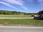
Tveit is the largest part of the borough by area, but it also has the smallest population of only about 1,000 people. Tveit is home to most of the farms in Kristiansand and only a few residential neighborhoods like Hamresanden, Brattvollsheia, and Solsletta.
Photos[edit]


See also[edit]
References[edit]
- ^ "Oddernes" (in Norwegian). Store norske leksikon. Retrieved 2009-11-10.
- ^ Rygh, Oluf (1912). Norske gaardnavne: Lister og Mandals amt (in Norwegian) (9 ed.). Kristiania, Norge: W. C. Fabritius & sønners bogtrikkeri. p. 9.
- ^ "Befolkning i Kristiansand". ssb.no. Retrieved 2014-01-01.
- ^ "MinSkole".
- ^ "Avinor - Kristiansand Lufthavn, Kjevik" (in Norwegian). Avinor. Retrieved 2015-01-01.
- ^ "Statens Vegvesen". vegvesen.no. Retrieved 2015-01-01.
- ^ "AKT". Archived from the original on 2019-07-25. Retrieved 2020-04-23.
- ^ "Kristiansand Dyrepark" (in Norwegian). Kristiansand Zoo and Amusement Park. Retrieved 2015-01-01.
External links[edit]
 Kristiansand travel guide from Wikivoyage