Otra
| Otra | ||
|
Otra below Skisland (Røyknesfjord) |
||
| Data | ||
| Water code | NO : 021.Z | |
| location | Agder ( Norway ) | |
| River system | Otra | |
| source | Setesdalsheiene, Nipadalen 59 ° 41 '50 " N , 7 ° 17' 51" O |
|
| Source height | 1232 m | |
| muzzle | near Kristiansand in Skagerrak Coordinates: 58 ° 8 ′ 40 ″ N , 8 ° 0 ′ 49 ″ E 58 ° 8 ′ 40 ″ N , 8 ° 0 ′ 49 ″ E |
|
| Mouth height | 0 m | |
| Height difference | 1232 m | |
| Bottom slope | 5 ‰ | |
| length | 247 km | |
| Catchment area | 3752 km² | |
| Discharge at the mouth of the A Eo : 3740 km² |
MQ Mq HHQ (October 1987) |
147 m³ / s 39.3 l / (s km²) 1000 m³ / s |
| Medium-sized cities | Kristiansand | |
|
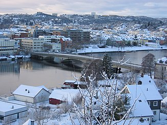
Otra in Kristiansand |
||
|
Tributaries and hydraulic structures
|
||||||||||||||||||||||||||||||||||||||||||||||||||||||||||||||||||||||||||||||||||||||||||||||||||||||||||||||||||||||||||||||||||||||||||||||||||||||||||||||||||||||||
The Otra is a 245 km long river in Fylke Agder in southern Norway . It flows through the Setesdal, which faces south .
course
The Otra rises in the Setesdalsheiene ( Bykle municipality ), flows south and flows into the Skagerrak at Kristiansand . It flows through two large lakes: the Åraksfjord and the Byglandsfjord .
The Otra is the ninth longest river in Norway . On average, the flow is 147 m³ / s. The highest flow rate was measured in October 1987 with approx. 1000 m³ / s. The catchment area is 3752 km².
Water quality and fishing
There is salmon farming operation and -fang.
The water quality has improved in recent years. The calcareous soil in the precipitation area in Setesdal compensates for the acidification of the water and the living conditions for salmon are very good.
Catches in recent years:
- 2001: 7.2 tons
- 2002: 5.3 tons
- 2003: 7.4 tons
- 2004: 5.8 tons
- 2005: 9.9 tons
- 2006: 10.7 tons
- 2007: 5.9 tons
- 2008: 7.9 tons
- 2009: 4.3 tons
- 2010: 6.8 tons
- 2011: 6.7 tons
There are also other species in the Otra such as trout , minnow and an endemic salmon fish , the bleke .

