Caririaçu: Difference between revisions
Content deleted Content added
+flag, +seal |
|||
| Line 12: | Line 12: | ||
|imagesize = |
|imagesize = |
||
|image_caption = |
|image_caption = |
||
|image_flag = |
|image_flag = BANDEIRA_OFICIAL_DO_MUNICÍPIO_DE_CARIRIAÇU.png |
||
|flag_size = |
|flag_size = |
||
|image_seal = |
|image_seal = Brasão_Caririaçu.jpg |
||
|seal_size = |
|seal_size = |
||
|image_map = |
|image_map = |
||
Revision as of 00:12, 24 March 2020
Caririaçu | |
|---|---|
Municipality | |
| Country | Brazil |
| Region | Nordeste |
| State | Ceará |
| Mesoregion | Sul Cearense |
| Population (2010) | |
| • Total | 26 393 |
| Time zone | UTC -3 |
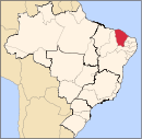
Caririaçu is a municipality in the state of Ceará in the northeast region of Brazil.[1][2][3]
See also
References
- ^ "Estimativas da população para 1º de julho de 2009" (PDF) (in Portuguese). Estimativas de População, Instituto Brasileiro de Geografia e Estatística (IBGE). August 14, 2009. Retrieved December 17, 2009.
- ^ "Ranking decrescente do IDH-M dos municípios do Brasil" (in Portuguese). Atlas do Desenvolvimento Humano, Programa das Nações Unidas para o Desenvolvimento (PNUD). 2000. Archived from the original on October 3, 2009. Retrieved December 17, 2009.
- ^ "IBGE | Cidades | Ceará | Caririaçu". cidades.ibge.gov.br. Retrieved 2016-05-30.
7°02′S 39°17′W / 7.033°S 39.283°W


