Camocim
Camocim | |
|---|---|
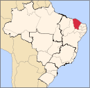
 Location in Ceará state | |
| Coordinates: 02°54′07″S 40°50′27″W / 2.90194°S 40.84083°W | |
| Country | Brazil |
| Region | Northeast |
| State | Ceará |
| Mesoregion | Noroeste Cearense |
| Microregion | Litoral de Camocim e Acaraú |
| Founded | September 29, 1879 |
| Government | |
| • Mayor | Monica Gomes Aguiar (PDT) |
| Area | |
| • Total | 1,124.78 km2 (434.28 sq mi) |
| Elevation | 8 m (26 ft) |
| Population (2020 [1]) | |
| • Total | 63,907 |
| • Density | 57/km2 (150/sq mi) |
| Demonym | Portuguese: Camocinense |
| Time zone | UTC−3 (BRT) |
| Postal code | 62400-000 |
| Area code | 88 |
| HDI | 0,620 |
| Website | www |
Camocim is a municipality in the state of Ceará, Brazil, founded in 1879. The population is 63,907 people (2020 estimate) in an area of 1,120.45 km2 (432.61 sq mi).[2]


