Clinton Municipal Airport (Iowa): Difference between revisions
m →top: replaced: public use → public-use, city owned → city-owned |
→See also: added another link |
||
| (9 intermediate revisions by 7 users not shown) | |||
| Line 3: | Line 3: | ||
| name = Clinton Municipal Airport |
| name = Clinton Municipal Airport |
||
| image = Clinton Municipal Airport (Iowa) - USGS 19 May 1994.jpg |
| image = Clinton Municipal Airport (Iowa) - USGS 19 May 1994.jpg |
||
| caption = [[USGS]] aerial image, 1994 ( |
| caption = [[USGS]] aerial image, 1994 (north is to the right) |
||
| IATA = CWI |
| IATA = CWI |
||
| ICAO = KCWI |
| ICAO = KCWI |
||
| Line 18: | Line 18: | ||
| pushpin_map = USA Iowa#USA |
| pushpin_map = USA Iowa#USA |
||
| pushpin_relief = yes |
| pushpin_relief = yes |
||
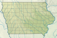
| pushpin_map_caption = Location of airport in Iowa / United States |
|||
| pushpin_label = '''CWI''' |
| pushpin_label = '''CWI''' |
||
| pushpin_label_position = left |
| pushpin_label_position = left |
||
| Line 37: | Line 36: | ||
}} |
}} |
||
'''Clinton Municipal Airport''' {{airport codes|CWI|KCWI|CWI}} is |
'''Clinton Municipal Airport''' {{airport codes|CWI|KCWI|CWI}} is seven miles southwest of [[Clinton, Iowa|Clinton]], in [[Clinton County, Iowa|Clinton County]], [[Iowa]].<ref name="FAA" /> The FAA's [[National Plan of Integrated Airport Systems]] (2017-2021) [[FAA airport categories|categorizes]] it as a ''[[general aviation]] airport''.<ref>[http://www.faa.gov/airports/planning_capacity/npias/ FAA National Plan of Integrated Airport Systems: 2009-2013]. Federal Aviation Administration. Published 1 October 2008.</ref> |
||
Clinton had scheduled airline flights from 1951-52 until 1975: Braniff until 1955, then Ozark. There was still commercial air service to Clinton into the mid-1980s. The Official Airline Guide in February 1985 showed a total of five weekday departures to O'Hare International in Chicago; Three via American Central and two via Great Lakes. Scheduled passenger service to Clinton was discontinued by the late 1980s. |
|||
| ⚫ | |||
| ⚫ | |||
| ⚫ | |||
| ⚫ | |||
| ⚫ | |||
| ⚫ | |||
| ⚫ | |||
| ⚫ | |||
| ⚫ | |||
| ⚫ | |||
| ⚫ | |||
| ⚫ | The airport is the site of the annual [[Cessna 150]] and [[Cessna 152]] fly-in, which began in 2001. The fly-in is open to owners, pilots and enthusiasts who share a common interest in those types of airplanes.<ref>{{cite web |url=http://www.cessna150152flyin.org/ |title=Home |website=cessna150152flyin.org}}</ref> |
||
==See also== |
|||
* [[List of airports in Iowa]] |
|||
* [[Clinton Municipal Transit Administration]] |
|||
== References == |
== References == |
||
Latest revision as of 19:51, 21 June 2023
Clinton Municipal Airport | |||||||||||||||
|---|---|---|---|---|---|---|---|---|---|---|---|---|---|---|---|
 USGS aerial image, 1994 (north is to the right) | |||||||||||||||
| Summary | |||||||||||||||
| Airport type | Public | ||||||||||||||
| Owner | City of Clinton | ||||||||||||||
| Serves | Clinton, Iowa | ||||||||||||||
| Elevation AMSL | 708 ft / 216 m | ||||||||||||||
| Coordinates | 41°49′52″N 090°19′45″W / 41.83111°N 90.32917°W | ||||||||||||||
| Website | www.clintonairport.us | ||||||||||||||
| Map | |||||||||||||||
| Runways | |||||||||||||||
| |||||||||||||||
| Statistics | |||||||||||||||
| |||||||||||||||
Clinton Municipal Airport (IATA: CWI, ICAO: KCWI, FAA LID: CWI) is seven miles southwest of Clinton, in Clinton County, Iowa.[1] The FAA's National Plan of Integrated Airport Systems (2017-2021) categorizes it as a general aviation airport.[2]
Clinton had scheduled airline flights from 1951-52 until 1975: Braniff until 1955, then Ozark. There was still commercial air service to Clinton into the mid-1980s. The Official Airline Guide in February 1985 showed a total of five weekday departures to O'Hare International in Chicago; Three via American Central and two via Great Lakes. Scheduled passenger service to Clinton was discontinued by the late 1980s.
Facilities[edit]

Clinton Municipal Airport covers 556 acres (225 ha) at an elevation of 708 feet (216 m). It has two asphalt runways: 3/21 is 5,204 by 100 feet (1,586 x 30 m) and 14/32 is 4,201 by 100 feet (1,280 x 30 m).[1]
In the year ending September 10, 2015 the airport had 15,400 aircraft operations, average 42 per day: 95% general aviation, 3% military and 2% air taxi. In April 2017, 40 aircraft were based at the airport: 30 single-engine, 3 multi-engine, 1 jet and 6 ultralight.[1]
Other uses[edit]
The airport is the site of the annual Cessna 150 and Cessna 152 fly-in, which began in 2001. The fly-in is open to owners, pilots and enthusiasts who share a common interest in those types of airplanes.[3]
See also[edit]
References[edit]
- ^ a b c d FAA Airport Form 5010 for CWI PDF, effective Apr 27, 2017.
- ^ FAA National Plan of Integrated Airport Systems: 2009-2013. Federal Aviation Administration. Published 1 October 2008.
- ^ "Home". cessna150152flyin.org.
External links[edit]
- Official website
- Clinton Municipal (CWI) at Iowa DOT Airport Directory
- FAA Airport Diagram (PDF), effective May 16, 2024
- FAA Terminal Procedures for CWI, effective May 16, 2024
- Resources for this airport:
- FAA airport information for CWI
- AirNav airport information for KCWI
- ASN accident history for CWI
- FlightAware airport information and live flight tracker
- NOAA/NWS weather observations: current, past three days
- SkyVector aeronautical chart, Terminal Procedures


