Gulbahor: Difference between revisions
Content deleted Content added
No edit summary |
mNo edit summary |
||
| (3 intermediate revisions by 2 users not shown) | |||
| Line 1: | Line 1: | ||
{{Infobox settlement |
{{Infobox settlement |
||
|settlement_type = Urban-type settlement |
|settlement_type = Urban-type settlement |
||
|official_name = |
|official_name = Gulbahor |
||
|native_name = |
|native_name = |
||
|image_skyline = |
|image_skyline = |
||
| Line 14: | Line 14: | ||
|pushpin_mapsize = 300 |
|pushpin_mapsize = 300 |
||
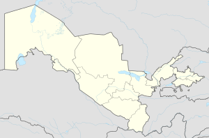
|pushpin_map_caption = Location in Uzbekistan |
|pushpin_map_caption = Location in Uzbekistan |
||
|coordinates_region = Uz |
|||
|subdivision_type = [[Countries of the world|Country]] |
|subdivision_type = [[Countries of the world|Country]] |
||
|subdivision_type1 = [[Regions of Uzbekistan|Region]] |
|subdivision_type1 = [[Regions of Uzbekistan|Region]] |
||
| Line 20: | Line 19: | ||
|subdivision_name1 = [[Tashkent Region]] |
|subdivision_name1 = [[Tashkent Region]] |
||
|subdivision_type2 = [[Districts of Uzbekistan|District]] |
|subdivision_type2 = [[Districts of Uzbekistan|District]] |
||
|subdivision_name2 = [[ |
|subdivision_name2 = [[Yangiyoʻl District]] |
||
|established_title = Urban-type settlement |
|established_title = Urban-type settlement |
||
|established_date = 1943 |
|established_date = 1943 |
||
|government_type = |
|government_type = |
||
| Line 46: | Line 45: | ||
|timezone_DST = |
|timezone_DST = |
||
|utc_offset_DST = |
|utc_offset_DST = |
||
|coordinates = {{coord|41|04|29|N|69|01|39|E|region:UZ_type:city|display=inline,title}} |
|||
|latd=41|latm=04|lats=29|latNS=N |
|||
|longd=69|longm=01|longs=39|longEW=E |
|||
|coordinates_type = region:UZ_type:city |
|||
|coordinates_display = yes |
|||
|elevation_footnotes = |
|elevation_footnotes = |
||
|elevation_m = |
|elevation_m = |
||
| Line 60: | Line 56: | ||
}} |
}} |
||
''' |
'''Gulbahor''' ({{lang-uz|Gulbahor/Гулбаҳор}}, {{lang-ru|Гульбахор}}) is an [[urban-type settlement]] in [[Tashkent Region]], [[Uzbekistan]]. It is part of [[Yangiyoʻl District]].<ref name=class>{{cite web|url=https://stat.uz/uploads/docs/soato(mhobt)_2020.xlsx|title=Classification system of territorial units of the Republic of Uzbekistan|language=uz, ru|date=July 2020|publisher=The State Committee of the Republic of Uzbekistan on statistics}}</ref> The town population in 1989 was 9,814 people.<ref>[http://demoscope.ru/weekly/ssp/sng89_reg2.php Population census-1989]</ref> |
||
==References== |
==References== |
||
{{Reflist}} |
{{Reflist}} |
||
| ⚫ | |||
[[Category:Populated places in Tashkent Region]] |
[[Category:Populated places in Tashkent Region]] |
||
[[Category:Urban-type settlements in Uzbekistan]] |
|||
{{Uzbekistan-geo-stub}} |
{{Uzbekistan-geo-stub}} |
||
| ⚫ | |||
Latest revision as of 11:43, 14 February 2022
Gulbahor | |
|---|---|
Urban-type settlement | |
| Coordinates: 41°04′29″N 69°01′39″E / 41.07472°N 69.02750°E | |
| Country | |
| Region | Tashkent Region |
| District | Yangiyoʻl District |
| Urban-type settlement | 1943 |
| Population (2002) | |
| • Total | 12,100 |
| Time zone | UTC+5 (UZT) |
Gulbahor (Uzbek: Gulbahor/Гулбаҳор, Russian: Гульбахор) is an urban-type settlement in Tashkent Region, Uzbekistan. It is part of Yangiyoʻl District.[1] The town population in 1989 was 9,814 people.[2]
References[edit]
- ^ "Classification system of territorial units of the Republic of Uzbekistan" (in Uzbek and Russian). The State Committee of the Republic of Uzbekistan on statistics. July 2020.
- ^ Population census-1989


