
Kostuchna
Kostuchna | |
|---|---|
 General view | |
 Location of Kostuchna within Katowice | |
| Coordinates: 50°11′19.85″N 18°59′28.3″E / 50.1888472°N 18.991194°E | |
| Country | |
| Voivodeship | Silesian |
| County/City | Katowice |
| Area | |
| • Total | 8.59 km2 (3.32 sq mi) |
| Population (2007) | |
| • Total | 8,233 |
| • Density | 960/km2 (2,500/sq mi) |
| Time zone | UTC+1 (CET) |
| • Summer (DST) | UTC+2 (CEST) |
| Area code | (+48) 032 |
Kostuchna (German: Kostuchna) is a district of Katowice. It has an area of 8.59 km2 and in 2007 had 8,233 inhabitants.[1]
-
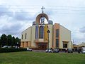 Holy Trinity church
.jpg)
References
Wikimedia Commons has media related to Kostuchna.
- ^ Urząd Miasta Katowice. "Katowice - Studium uwarunkowań i kierunków zagospodarowania przestrzennego" (PDF) (in Polish). Archived from the original (PDF) on 2011-11-04. Retrieved 2011-06-16.
| I. Central District |
| |
|---|---|---|
| II. Northern District |
| |
| III. Western District | ||
| IV. Eastern District |
| |
| V. Southern District |
| |
This Silesian Voivodeship location article is a stub. You can help Wikipedia by expanding it. |