Île de Sable (Phantom Island)
Coordinates: 19 ° 13 ′ S , 159 ° 55 ′ E
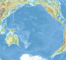
Île de Sable ("island of sand") or Sandy Island ( Sable Island ), also known as Sable for short on German maps , is the name of a phantom island in the Coral Sea between Australia and New Caledonia with a supposed size of almost 120 square kilometers.
The French navigator Joseph Bruny d'Entrecasteaux discovered several islands between June 28 and July 1, 1792, including an island called Île du Sable . This was an island of the Récifs-d'Entrecasteaux group off the north-western tip of New Caledonia. In 1876 the whaling ship Velocity sighted an island also known as Sandy Island (both as "islands" and surf waves) at S19 ° 14 '; E159 ° 56 'or S19 ° 50'; E158 ° 51 '. This island was probably a length shift of the easternmost islets of the Chesterfield Group further to the west. Because of the danger that small islands posed to shipping, unconfirmed sightings of islands were often recorded on maps, so that various other phantom islands can still be found on many maps today.
A non-existent island called Île de Sable or Sandy Island is still included in many maps, such as Île de Sable in some editions of the Times Atlas of the World . The supposed location of the island roughly corresponds to one of the sighting locations of Velocity . The island was also temporarily noted on Google Maps ; In contrast, Google Earth showed a black spot where the island was suspected. On the Google maps on the sea floor you can still see the outline of an elevation.
Some atlases cite the US secret service CIA as the source for the existence and location . Researchers from the University of Sydney thoroughly searched the region in which the island was listed in 2012, but only found water depths of more than 1,300 meters, which triggered international media coverage. As a result, many map manufacturers deleted the island from their works. The non-existence had already been confirmed in 1979 by the French naval map service ( SHOM ) and taken into account in French map material. There was also a non-scientific exploration of the waters in 2000.
Web links
Individual evidence
- ↑ for example in the Bertelsmann House Atlas, Gütersloh 1960
- ↑ a b c d Frank Jacobs: No Land Ho: Sandy Island and the Age of Un-Discovery. In: Strange Maps. Big Think, November 28, 2012, accessed December 1, 2012 .
- ^ John Dunmore: French explorers in the Pacific, Vol. 1: The eighteenth century; Oxford 1965 (pp. 301f.); see. http://upload.wikimedia.org/wikipedia/commons/b/ba/New_Caledonia_and_Vanuatu_bathymetric_and_topographic_map-fr.svg
- ↑ Doubtful hydrographic data = Données hydrographiques douteuses / International Hydrographic Bureau, Pt. E: South Pacific Ocean; Monaco 1968–1969 (3rd ed.) (P. 48)
- ↑ a b Hélène Lecornu: Sandy Island: le mystère de l'île fantôme dévoilé depuis déjà 33 ans ( French , .doc) SHOM. December 12, 2012. Retrieved December 9, 2017.
- ^ South Pacific Sandy Island 'proven not to exist'. BBC, November 22, 2012, accessed November 22, 2012 .
- ^ Scientists un-discover Pacific island. The News International, November 22, 2012, accessed November 22, 2012 .
- ↑ a b c Axel Bojanowski : Sandy Island is a phantom. Map mystery off Australia. In: Spiegel Online. November 22, 2012. Retrieved November 22, 2012 .
- ↑ Google Maps. Accessed December 31, 2017 .
- ↑ Juan Valdes: Sandy Island (Île de Sable or Île de Sables): The Island That Never Was. National Geographic , November 29, 2012, accessed December 1, 2012 .
- ↑ TXØDX Bulletin 16. TXØDX Challenges National Geographic. April 10, 2000, accessed December 1, 2012 .


