Öskemen dam
| Öskemen dam | |||||||||||
|---|---|---|---|---|---|---|---|---|---|---|---|
|
|||||||||||
|
|
|||||||||||
| Coordinates | 49 ° 54 '5 " N , 82 ° 43' 8" E | ||||||||||
| Data on the structure | |||||||||||
| Construction time: | 1939-1954 | ||||||||||
| Power plant output: | 332 MW | ||||||||||
| Data on the reservoir | |||||||||||
| Altitude (at congestion destination ) | 328 m | ||||||||||
| Water surface | 37 km² | ||||||||||
| Reservoir length | 77 km | ||||||||||
| Reservoir width | 1.2 km | ||||||||||
| Storage space | 650 million m³ | ||||||||||
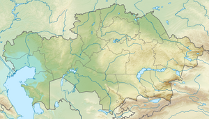
The Öskemen Dam ( Kazakh Өскемен бөгені ) is located in eastern Kazakhstan 5 km upstream from the city of Öskemen ( Ust-Kamenogorsk ) on the Irtysh .
The dam was completed in 1952. It dams the river over a length of 77 km. The reservoir covers an area of 37 km² and has a maximum width of 1.2 km. The storage volume is 650 million m³. The Buchtarma dam is located upstream, and the Schülbi dam is downstream .
The associated hydropower plant was completed in 1939–1954. It has 4 units of 83 MW and thus a total installed capacity of 332 MW. The average annual output is 1580 million kWh. The drop height is 41.8 m.
See also
Individual evidence
- ↑ a b Article Öskemen Reservoir in the Great Soviet Encyclopedia (BSE) , 3rd edition 1969–1978 (Russian)
- ↑ a b c d Article Öskemen hydroelectric power plant in the Great Soviet Encyclopedia (BSE) , 3rd edition 1969–1978 (Russian)

