
East Kazakhstan
|
East Kazakhstan region Шығыс Қазақстан облысы Восточно-Казахстанская область |
||
|
||
| Basic data | ||
|---|---|---|
| State : |
|
|
| Administrative headquarters : | Öskemen | |
| Founded: | March 10, 1932 | |
| Area : | 283,226 km² | |
| Residents : | 1,369,597 (Jan 1, 2020) | |
| Population density : | 5 inhabitants per km² | |
| Time zone : | EKST ( UTC + 6 ) | |
| Postal code : | 07xxxx | |
| Telephone code : | +7 (722), (723) | |
| License plate : | 16 (old: F, U) | |
| KATO code: | 630000000 | |
| ISO 3166-2 : | Concentration camp VOS | |
| Äkim ( governor ) : | Danial Akhmetov | |
| Website : | ||
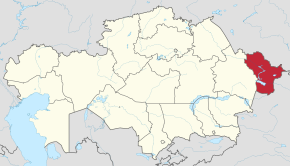
| Location in Kazakhstan | ||
  |
||

The East Kazakhstan region ( Kazakh Шығыс Қазақстан облысы / Schyghys Qasaqstan oblysy ; Russian Восточно-Казахстанская область / Vostochno-Kazakhstan is one of the north-east of Kazakhstan and is located in the north-east of Kazakhstan Oblast . Its area is 283,200 square kilometers and its population is 1,369,635 (2020). The population consists of 54.5 percent Kazakhs , 40.5 percent Russians , and 5 percent other nationalities.
geography
The eastern part of Oblysy lies largely in the Altai Mountains along with the Qalbagebirge . The highest point is the Belucha on the border with Russia at 4506 m . The average temperatures in January are between −17 ° C and −26 ° C, in July between 19 ° C and 23 ° C. Between 120 mm and 1500 mm (in the mountains) of precipitation fall annually. The largest river is the Irtysh , other larger rivers are the Uba , Kurtschum and Buchtarma . Larger lakes are the Saissansee , which merges into the Buchtarma reservoir , as well as Markakol and Alaköl-See , in which the Oblysy has a share.
history
At the time of the Soviet Union , the two oblasts of Semipalatinsk and East Kazakhstan existed in the area of today's Oblysy , which were merged in 1997 in an administrative reform to form today's East Kazakhstan area.
Semipalatinsk nuclear test site
Near Semipalatinsk who entertained Soviet Union with the Semipalatinsk Test Site one of its largest nuclear test site . Erected in 1946, a total of 498 nuclear tests were carried out there between 1949 and 1989, mostly for military purposes. The first Soviet atomic bomb was detonated here on August 29, 1949, and the world's first hydrogen bomb on August 12, 1953 . The tests took place in the atmosphere or on the ground until 1962, after which they were carried out underground. The approximately 18,000 km² test site was secret and strictly shielded. The uninformed population in the area, especially the herdsmen, suffered from severe health impairments. A contamination occurred within a radius of up to 200 km.
population
Population groups
| Ethnic group | VZ 1989 | VZ 1999 | VZ 2009 | |||
|---|---|---|---|---|---|---|
| number | % | number | % | number | % | |
| Kazakhs | 687.879 | 38.92 | 743.098 | 48.54 | 781.732 | 55.97 |
| Russians | 914.424 | 51.74 | 694.705 | 45.38 | 561.183 | 40.18 |
| Tatars | 27,982 | 1.58 | 24,506 | 1.60 | 17,789 | 1.27 |
| German | 66,924 | 3.79 | 32.141 | 2.10 | 14,030 | 1.00 |
| Ukrainians | 35,702 | 2.02 | 15.969 | 1.04 | 7,078 | 0.51 |
| Belarusians | 9,085 | 0.51 | 4,524 | 0.30 | 1999 | 0.14 |
| Chechens | 2,790 | 0.16 | 1,690 | 0.11 | 1,651 | 0.12 |
| Korean | 1,553 | 0.09 | 1,574 | 0.10 | 1,491 | 0.11 |
| Azerbaijanis | 1,744 | 0.10 | 1,426 | 0.09 | 1,373 | 0.10 |
| Uzbeks | 2,346 | 0.13 | 1,203 | 0.08 | 1,215 | 0.09 |
| Other | 21,340 | 1.20 | 10,188 | 0.67 | 7,325 | 0.52 |
Population development
|
|
|
|
 |
¹ census result
Politics and administration
Administrative division
The area is divided into 19 districts ( Kazakh Ауданы Audany ; Russian Район Rajon ). The cities of Kurchatov , Ridder , Öskemen and Semei each represent their own urban district. Other cities are Altai , Ajagös , Saissan , Schar , Schemonaicha and Serebrjansk .

| Audany | Area [km²] | Residents | Administrative headquarters |
|---|---|---|---|
| Abai | 21,100 | 14,147 | Qarauyl |
| Ajagös | 37,878 | 71,670 | Ajagös |
| Altai | 10,500 | 64,791 | Altai |
| Besqaraghai | 11,300 | 18,299 | Besqaraghai |
| Borodulicha | 7,200 | 35,403 | Borodulicha |
| Glubokoje | 7,300 | 60,999 | Glubokoje |
| Kökpekti | 14,600 | 27,597 | Kökpekti |
| Furrichim | 23,200 | 23,408 | Furrichim |
| Kurchatov (city) | 110 | 12,317 | Kurchatov |
| Öskemen (city) | 600 | 346.127 | Öskemen |
| Qaton Qaraghai | 13,200 | 22.306 | Ülken Naryn |
| Ridder (city) | 3,400 | 56,455 | Ridder |
| Saissan | 10,400 | 36,698 | Saissan |
| Sharma | 22,600 | 37,042 | Calf dew |
| Shemonaicha | 4,000 | 42,981 | Shemonaicha |
| Semei (city) | 27,700 | 349,957 | Semei |
| Tarbaghatai | 23,800 | 38,053 | Aqsuat |
| Ulan | 9,500 | 38,585 | Qassym Qaissenow |
| Urschar | 23,400 | 72,762 | Urschar |
| As of January 1, 2020 | |||
Äkim (governor)
List of governors ( Kazakh Әкім , Äkim ) of the Eastern Kazakhstan region since 1992:
| No. | Surname | Term of office (beginning) | Term of office (end) |
|---|---|---|---|
| 1 | Amangeldi Bektemisov | February 1992 | June 17, 1994 |
| 2 | Yuri Lavrinenko | June 17, 1994 | November 30, 1995 |
| 3 | Leonid Dessjatnik | November 30, 1995 | April 10, 1996 |
| 4th | Qashymurat Naghymanov | April 10, 1996 | April 17, 1997 |
| 5 | Wiltali Mette | April 17, 1997 | February 27, 2003 |
| 6th | Talghatbek Abaidildin | February 27, 2003 | December 8, 2004 |
| 7th | Viktor Khrapunov | December 8, 2004 | January 11, 2007 |
| 8th | Schänibek Karibschanow | January 11, 2007 | May 7, 2008 |
| 9 | Ädilghasy Bergenow | May 7, 2008 | March 4, 2009 |
| 10 | Berdibek Saparbayev | March 4, 2009 | November 11, 2014 |
| 11 | Danial Akhmetov | November 11, 2014 | officiating |
Economy and Infrastructure
In the mountain region, non-ferrous metal processing is predominant due to the natural resources available there. The main industries are mechanical engineering, metal processing, wood industry, light industry, food industry and the production of building materials. There are three hydropower plants on the Irtysh.
In agriculture, the cultivation of wheat, sunflowers, potatoes, vegetables and fruit dominate. Cattle, sheep, goats, pigs and horses are kept, and meat, milk and hides are used as agricultural products. Beekeeping, fish farming and fur farming are also widespread. The Irtysh is navigable.
Web links
- Official website of the East Kazakhstan region (English, Kazakh and Russian)
Individual evidence
- ↑ Численность населения Республики Казахстан по полу в разрезе областей и столицы, столицы, столицы, анколицы, столицы, городоав, областей и столицы, анкония, горойцы, коники, городоав,. ( Excel ; 96 KB) stat.gov.kz, accessed on July 19, 2020 (Russian).
- ↑ Ethnic composition: 1989 census (data for regions). pop-stat.mashke.org, accessed August 9, 2020 (Russian).
- ↑ Ethnic composition: 1999 census (data for regions). pop-stat.mashke.org, accessed August 9, 2020 (Russian).
- ↑ Ethnic composition: 2009 census. pop-stat.mashke.org, accessed August 9, 2020 (Russian).
| Areas |
Almaty | Aqmola | Aqtobe | Atyrau | Mangghystau | North Kazakhstan | East Kazakhstan | Pavlodar | Karaganda | Qostanai | Qysylorda | Shambyl | Turkistan | Western Kazakhstan |
|
| Cities with special status |
Coordinates: 50 ° 0 ' N , 82 ° 0' E