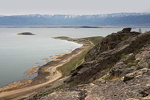
Buchtarma reservoir
| Buchtarma reservoir | |||||||||
|---|---|---|---|---|---|---|---|---|---|
|
|||||||||
|
|
|||||||||
| Coordinates | 49 ° 39 '26 " N , 83 ° 20' 50" E | ||||||||
| Data on the structure | |||||||||
| Construction time: | -1960 | ||||||||
| Height above foundation level : | 90 m | ||||||||
| Building volume: | 1.17 million m³ | ||||||||
| Crown length: | 430 m | ||||||||
| Power plant output: | 675 MW | ||||||||
| Data on the reservoir | |||||||||
| Water surface | 5,490 km² | ||||||||
| Storage space | 49,800 million m³ | ||||||||
The Buchtarma reservoir is located on the upper reaches of the Irtysh in Kazakhstan .
The reservoir is located between Ust-Kamenogorsk and Saissan south of the mouth of the Buchtarma on the south-western edge of the Altai Mountains. Including Lake Saissan, which is flooded by the damming of the river, it covers an area of 5,490 km² when the river is fully dammed, making it one of the 10 largest in the world, and comprises a maximum of 49.80 km³ storage volume. Its length is then 500 km, its width 35 km and the average depth 9 m.
The barrier structure of the Buchtarma reservoir, built around 1960 , is located near Serebryansk . It is a gravity dam . The hydropower plant there is owned by Samruk-Energo and operated by Kazzinc . It is used to generate energy (output 675 MW ); With the help of the dam, the water supply for the Irtysh is regulated, which improves the navigation conditions. The lake is used, among other things, for fishing .
In the Buchtarma dam the river flows, among others, the right Buchtarma . Big cities on the reservoir are Syrianovsk and Saissan .
See also
- List of power plants in Kazakhstan
- List of dams in the world (Kazakhstan)
- List of the largest dams on earth
- List of the largest reservoirs on earth
- List of the largest hydroelectric plants in the world
Web links
- Article Buchtarma Reservoir in the Great Soviet Encyclopedia (BSE) , 3rd edition 1969–1978 (Russian)
- Photos from the Buchtarma Reservoir, Syrianovsk
- Panoramic views of the Buchtarma reservoir, Syrianovsk and the surrounding area
- Satellite image of East Kazakhstan and Buchtarma Reservoir

