Čertova hora
| Čertova hora
Teufelsberg
|
||
|---|---|---|
| height | 1020 m nm | |
| location | Reichenberg , Czech Republic | |
| Mountains | Giant Mountains | |
| Coordinates | 50 ° 45 ′ 41 ″ N , 15 ° 25 ′ 46 ″ E | |
|
|
||
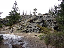
| rock | granite | |
The Čertova hora ( Devil's Mountain ) is a 1020 m high mountain in the western part of the Giant Mountains in the Czech Republic near the border with Poland .
location
The Teufelsberg is located south of Harrachov ( Harrachsdorf ) on the western continuation of the inner Giant Mountains ridge , the Český hřeben ( Czech ridge ). This foothill of the Giant Mountains begins at Lysá hora ( Kahleberg ) and ends here. Its slopes fall steeply in the surrounding valleys, except in the southeast, where the up rock group Janova scale ( John rock ) is a secondary peak at 1002 m nm , of the inner ridge following, a flatter saddle of about 965 meters in height with the Kotel ( Kesselkoppe ) is connected.
Nearby peaks
| Tkacka Gora | Bílý Vrch | Kamenec |
| Kapradnik |

|
Plešivec |
| Hromovka | Janova skála | Studená |
Hydrology
The southwest side is drained into the Jizera ( Iser ) via several small streams . The water on the eastern slope flows into the Ryžovištní potok ( soap stream ), which, like the water on the northern slope, flows into the Velka Mumlava ( Great Mummel ). This finally connects below the northwest side with the Milnice ( Millnitz ) to the Mumlava , which also flows into the Jizera below the western slope, which it drains.
Flora, fauna and nature conservation
The mountain is located in the outer zone of the Czech National Park Giant Mountains ( Krkonošský národní park ). The spruce forest, which is only interrupted on the ski slopes, extends down into the valleys and provides a habitat for the pine jay, the rough owl and various species of woodpecker.
tourism
Although the mountain is primarily known as the venue for international competitions in the classic ski disciplines, it is a very good starting point for numerous sports and leisure opportunities in all seasons and offers a wonderful view of the Krkonoše main ridge, the Jizera Mountains and the surrounding area.
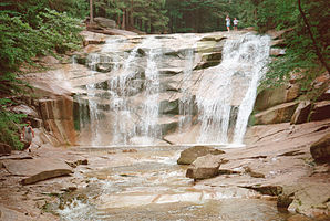
In the winter season, the ski lifts from Rýžoviště lead up to slopes of all levels of difficulty. For cross-country skiers there are a large number of trails at the foot of the mountain, which among other things lead along the Mumlava to the waterfalls.
In summer, the summit, which can be easily reached with the chairlift, is the starting point for hikes and bike tours over the ridges of the Czech ridge. A take-off area as well as a reserved flight corridor and landing area for paraglider and stunt kite pilots have also been set up here.
Winter sports
Count Harrach brought the first skis to Bohemia in 1887 when he had hunters and foresters on his estates equipped with skis. This triggered a skiing boom. In 1908 the "Spolek zimních sportů" ( winter sports club ) was founded.
On the slopes in the northeast is the Rýžoviště ski area, where the first international ski race was held in 1923. The best skiers from many European countries and the USA have always taken part in the race, which has been held regularly since 1954.
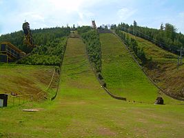
The first ski jumping hill of today's ski jumping complex Čerťák was built on the northern slope in 1920 . In 1980, ski jumps and cross-country skiing areas were renovated and what was then the highest jump in the world was built, which with a K-point of 185 meters is still one of the five ski jumping hills in the world on which World Cup competitions or championships can be held. The other jumps have K-points of 125, 90, 70 and 40 meters.


