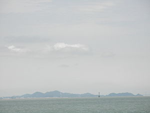
Ōge-jima
| Ōge-jima | ||
|---|---|---|
| Ōge-jima | ||
| Waters | Seto Inland Sea | |
| Geographical location | 34 ° 13 '0 " N , 134 ° 37' 30" E | |
|
|
||
| length | 6 km | |
| width | 2 km | |
| surface | 7.31 km² | |
| Highest elevation | Mitsuishi-yama 198.5 m |
|
| Residents | 2686 (March 31, 2015) 367 inhabitants / km² |
|
| main place | Naruto-cho | |
| Mitsuishi-yama | ||
Ōge-jima or Ōge-shima ( Japanese 大毛 島 ) is a Japanese island in the Seto Inland Sea .
geography
The 7.31 km² island is located southwest of Awaji-shima separated by the Naruto Strait and northeast of Shikoku separated by the Konaruto Strait ("small Naruto Strait"). Shimada-shima extends to the northwest and Takashima to the southwest . The body of water between the three islands is called Uchi-no-umi ( ウ チ ノ 海 , "inner sea"). Due to landfills between Ōge-jima and Takashima, these now form a double island with both parts separated by a 50 m wide canal. Suku-no-umi ( ス ク ノ 海 ; 34 ° 12 ′ 30 ″ N , 134 ° 36 ′ 30 ″ E ) lies between the two islands in the north and is connected to the sea by the channel in the south and a lock in the north . Other surrounding islands are Hadaka-jima ( 裸 島 ; 34 ° 14 ′ 13 ″ N , 134 ° 38 ′ 43 ″ E ) in the north and Tobishima ( 飛 島 ; 34 ° 14 ′ 54 ″ N , 134 ° 38 ′ 53 ″ E ) in the Northeast.
The highest point is the Mitsuishi-yama ( 三 ツ 石山 ) in the south with 198.5 m - in the north there is the Ōge-yama ( 大毛 山 ) with 149.3 m.
The island consists of two upper districts ( ōaza ) of the municipality of Naruto : Narutochō-Mitsuishi ( 鳴 門 町 三 ツ 石 ) in the southeast near Takashima and Narutochō-Tosadomariura ( 鳴 門 町 土 佐 泊 浦 ) in the north, center and southwest. Mitsuishi is divided into the suburbs ( koaza ) Ejiriyama ( 江 尻 山 ) in the southwest, Fuyōzanka ( 芙蓉 山下 ) in the north, Minamiōte ( 南大 手 ) in the southeast, and Hachikenhama which, however, belongs to Takashima. Tosadomariura is divided from north to south into Fukuike ( 福 池 ), Ōge ( 大毛 ), the Tanoura ( 田 ノ 浦 ), Kuroyama ( 黒 山 ), Ōtani ( 大谷 ), Takasuna ( 高 砂 ) along the southeast coast ( 江 尻 山 ), Wakiguchi ( 脇 口 ) and Tosadomariura ( 土 佐 泊 ) along the southwest coast. As of March 31, 2015, there were 2686 residents on the island.
traffic
The island is an important waypoint on the Kobe-Awaji-Naruto highway and is connected to Awaji-shima in the north via the Ōnaruto Bridge ("Great Naruto Bridge"). The highway then crosses the island through the 1st and 2nd Naruto tunnel and finally leads over the Muya Bridge to Shikoku . The older Konaruto Bridge ( 小 鳴 門橋 , Konaruto-bashi ; "small Naruto Bridge") runs parallel to the Muya Bridge ( 撫養 橋 , Muya-bashi ). Shimada-jima can be reached via the Horigoe Bridge ( 堀 越 橋 , Horigoe-bashi ), which is part of the Naruto Skyline Panorama Road .
Attractions
From the northernmost point of the island, Cape Magosaki ( 孫 崎 ), the Naruto whirlpool can be seen. In addition, Ōge-jima is home to the Ōtsuka Art Museum , which on 29,412 m² of exhibition space - the largest in Japan - presents reproductions, including 1000 masterpieces of ceramics, as well as paintings such as Michelangelo's ceiling fresco in the Sistine Chapel .
Web links
Individual evidence
- ↑ a b 17 小字 別 世 帯 数 と 人口 (そ の 1) . Naruto March 31, 2015; archived from the original on August 2, 2016 ; Retrieved August 2, 2016 (Japanese).
- ↑ a b 島 面積 . (PDF; 136 kB) Kokudo Chiriin , October 1, 2015, archived from the original on June 15, 2016 ; Retrieved August 2, 2016 (Japanese).
- ↑ 大毛 島 . In: ブ リ タ ニ カ 国際 大 百科 事 典 小 項目 事 典 , 日本 の 地名 が わ か る 事 典 and 日本 大 百科全書 at kotobank.jp. Retrieved July 18, 2015 (Japanese).
- ↑ 鯔 越 樋 門 . Tokushima Prefecture, accessed July 20, 2015 (Japanese).
- ↑ a b official topographic map of Kokudo Chiriin
- ↑ Otsuka Museum of Art. Japan National Tourism Organization, accessed on July 18, 2015 (English).


