A84 road
| A84 road in the UK | |

|
|
| map | |
| Basic data | |
| Operator: | |
| Start of the street: |
Stirling ( 56 ° 8 ′ N , 3 ° 56 ′ E ) |
| End of street: |
Lochearnhead ( 56 ° 23 ' N , 4 ° 17' O ) |
| Overall length: | 47.7 km (29.6 mi ) |
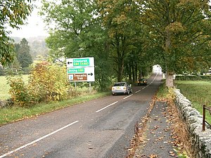
| Kilmahog Junction near Callander (photo 2005) | |
The A84 road ( English for road A84 ) is a 47.7 km long, continuously designated primary route road in Scotland, which connects Stirling with Lochearnhead .
course
The A84 branches off the A9 road to the northwest in Stirling , crosses the M9 motorway at its junction 10 and runs via Doune , Callander , where the A81 road coming from Glasgow meets it, and Strathyre to Lochearnhead at the west end of Loch Earn . There it ends on the A85 road .

