Agay (river)
| Agay | ||
|
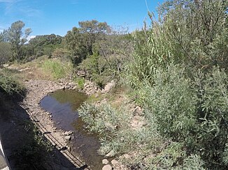
Grenouillet at the Pont du Grenouillet |
||
| Data | ||
| Water code | FR : Y5500540 | |
| location | France , Provence-Alpes-Cote d'Azur region | |
| River system | Agay | |
| source | Sommet des Petites Grues 43 ° 29 ′ 2 ″ N , 6 ° 54 ′ 44 ″ E |
|
| Source height | 240 m | |
| muzzle | Mediterranean Coordinates: 43 ° 25 ′ 54 " N , 6 ° 51 ′ 28" E 43 ° 25 ′ 54 " N , 6 ° 51 ′ 28" E |
|
| Mouth height | 0 m | |
| Height difference | 240 m | |
| Bottom slope | 22 ‰ | |
| length | 11 km | |
| Catchment area | 171 km² | |
The Agay , known as the Grenouillet in the middle reaches , is a temporary river in south-east France that runs in the Var department in the Provence-Alpes-Côte d'Azur region . It rises in the Esterel Mountains , flows mainly in a roughly south-westerly direction, then turns to the south-east and flows into the Mediterranean after 11 km near the village of Agay .
Web links
Commons : Agay (cours d'eau) - collection of images, videos and audio files
