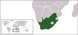
Agulhas National Park
|
Agulhas National Park
|
|
| location | South Africa |
| surface | 56.9 km² |
| WDPA ID | 301881 |
| Geographical location | 34 ° 50 ′ S , 20 ° 0 ′ E |
| Setup date | September 14, 1998 |
| administration | South African National Parks |
The Agulhas National Park ( English Agulhas National Park ) is located at the southernmost point of Africa, at Cape Agulhas in the Western Cape Province in South Africa . The park area extends from Gansbaai in the west to Struisbaai in the east, the length is 72 km and the width varies from 7 to 25 km.
The area around the southernmost point of Africa (also known as the Agulhas Plain) has a variety of natural and cultural features that justify the status as a national park. The national park is of international importance due to its biodiversity, comparable to the tropical rainforest. It is home to around 2,000 species of native plants, 100 of which are endemic and 110 are on the red list of threatened species. The area is an important distribution area for the Cape flora .
The Mediterranean climate is mild, with an average air temperature of 15 ° C, the annual precipitation fluctuates between 400 and 600 mm, the majority of which falls between May and September.
Individual evidence
- ↑ Park Management Plan 2006 (PDF; 761 kB)
Web links
- South African National Parks: Agulhas National Park . National park administration website at www.sanparks.org (English)

