Aleghero
| Aleghero | ||
|---|---|---|
| Waters | Venice lagoon | |
| Geographical location | 45 ° 12 '30.5 " N , 12 ° 15' 29.7" E | |
|
|
||
| surface | 2.7 ha | |
| Residents | uninhabited | |
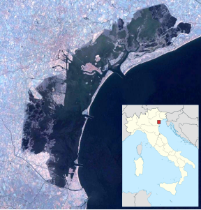
Aleghero is a small island in the south of the Venice lagoon . It has an area of 2.7 hectares and is located there in the south of the Val da Rio near Chioggia .
The southern lagoon was reduced in size in the 1960s, cut up by a trunk road that crosses the lagoon south of Aleghero, and planned for the expansion of the port of Chioggia . Possibly the island will be connected to the mainland by a road and will receive the fish market, which is supposed to disappear from one of the neighboring islands called Cantieri .
history
In one of the four wars between Genoa and Venice , the Chioggia War , the small island played a significant role as a gathering point for troops in 1378. From 1545 a canal reached the lagoon opposite Aleghero, which the Paduans had built.
The extreme south of the lagoon, the Val di Brenta, was cut off from the rest of the lagoon in 1966 by the state road n. 309 (Romea), which connects Ravenna (and Chioggia) with Mestre . This was done locally as part of an industrialization project, which focused on the enlargement and deepening of the port of Chioggia and the development of traffic. Only four breakthroughs or two bridges lead through the road embankment, which correspond to the four canals Otregan, Lombardo, Trezze and Aleghero. These canali were considerably disturbed in their natural course and their fluctuating water flow. Only the Trezze Canal with a depth of 3 m is still hydrologically functional and does not threaten to silt up.
Remarks
- ↑ Venice islands: All the islands of Venice by area ( Memento of March 24, 2009 in the Internet Archive )
- ↑ Wolfgang Schippke: The Islands round Chioggia ( Memento from March 4, 2016 in the Internet Archive )
- ↑ Archivio di oceanografia e limnologia , ed. from the Istituto di biologia del mare del Consiglio Nazionale delle Ricerche, 1987, p. 120.
