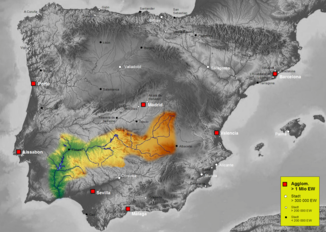
Aljucén (Guadiana)
| Río Aljucén | ||
|
Guadiana river system |
||
| Data | ||
| location | Spain , Extremadura | |
| River system | Guadiana | |
| Drain over | Guadiana → Atlantic Ocean | |
| source |
Sierra de Montánchez 39 ° 13 ′ 29 " N , 6 ° 9 ′ 43" W. |
|
| Source height | approx. 605 m | |
| muzzle |
Guadiana Coordinates: 38 ° 56 ′ 9 ″ N , 6 ° 24 ′ 22 ″ W 38 ° 56 ′ 9 ″ N , 6 ° 24 ′ 22 ″ W. |
|
| Mouth height | approx. 205 m | |
| Height difference | approx. 400 m | |
| Bottom slope | approx. 10 ‰ | |
| length | approx. 40 km | |
| Catchment area | approx. 500 km² | |
| Communities | Aljucén | |
The Río Aljucén is an approx. 40 km long right (northern) tributary of the Río Guadiana , which flows through the province of Badajoz in the autonomous community of Extremadura in southern Spain .
course
The source of the Río Aljucén is located on the south side of the Sierra de Montánchez about 1 km west of the village of Montánchez . Overall, it flows in a south-westerly direction, crosses the north of the Cornalvo Nature Park and finally flows into the dammed Río Guadiana about 6 km west of Mérida .
Tributaries
Numerous streams (arroyos) flow into the Río Aljucén; nevertheless, the river falls almost dry in the summer months with little rain.
nature
The Río Aljucén flows through sparsely populated and largely unused landscapes; it is not dammed and is therefore one of the few remaining natural rivers in Spain.
history
In the town of Aljucén , the river crosses the Via de la Plata, which was used in ancient times and in the Middle Ages . The Romans built a (largely destroyed) bridge here.
Web links
- Río Aljucén - Photos + Info (Spanish)
- Río Aljucén - Photos + Info (Spanish)
