Alpenklubscharte
| Alpenklubscharte | |||
|---|---|---|---|
|
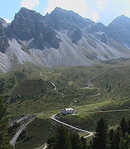
Adolf-Pichler-Hütte with Alpenklubscharte on the left |
|||
| Compass direction | Northwest | southeast | |
| Pass height | 2451 m above sea level A. | ||
| state | Tyrol | ||
| Valley locations | Adolf Pichler Hut | Schlicker Alm | |
| expansion | alpine route (alpine transition) | ||
| Mountains | Stubai Alps | ||
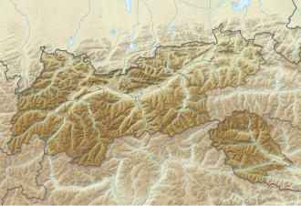
| Map (Tyrol) | |||
|
|
|||
| Coordinates | 47 ° 9 '39 " N , 11 ° 16' 45" O | ||
The Alpenklubscharte is 2451 m above sea level. A. high transition in the Stubai Alps in Tyrol from the Adolf-Pichler-Hütte to the Schlicker Alm . It lies between the 2633 m high Steingrubenkogel in the northeast and the Kleiner Ochsenwand (2553 m) in the southwest.
The Schlicker via ferrata leads from the Alpenklubscharte via the Kleine Ochsenwand to the Großer Ochsenwand and the west ridge to the Steingrubenkogel. The saddle can be reached in 3 ½ hours from the Froneben middle station.
Individual evidence
- ↑ Schlicker Klettersteig , klettersteig.de
- ↑ Steingrubenkogel via ferrata , bergstieg.com


