Am Stadtpark (Munich)
| At the city park | |
|---|---|
| Street in Munich | |
| Basic data | |
| State capital | Munich |
| Borough | Pasing-Obermenzing |
| Created | around 1900 |
| Name received | 1947 |
| Connecting roads | Maria-Eich-Strasse, Wiesengrund |
| Cross streets | Avenariusstrasse, Bachmairstrasse, Bierbaumstrasse, Endeweg, Wehnerstrasse , Lichtingerstrasse, Wunderlichstrasse, Dachstrasse , Pfeivestlstrasse, Egenhoferstrasse |
| Places | Avenariusplatz |
| Numbering system | Orientation numbering |
| Buildings | University of Applied Sciences Munich , Karlsgymnasium |
| use | |
| User groups | Pedestrian traffic , bicycle traffic , individual traffic |
| Road design | asphalt |
| Technical specifications | |
| Street length | 1.2 km |
The road at the city park is located in the Munich district Pasing . It was created around 1900.
history
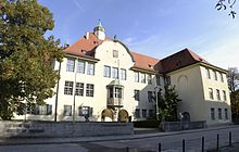
The street of the forest colony Pasing branches off at Avenariusplatz from Maria-Eich-Straße and runs parallel to the Pasing city park and the Würm up to the city limits. It originated from a road to Lochham . At the beginning the street is framed by the Karlsgymnasium and the former teacher training college . Most of the villas or houses were built after the Second World War , so that the historical buildings form the minority.
Known residents
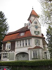
Am Stadtpark 43 (now Endeweg 5): Louis Ende , the architect and founder of the Pasing Forest Colony , lived in the villa and had his office in an adjoining building.
Architectural monuments
There are six official architectural monuments:
- Former teacher training college
- Karlsgymnasium
- Am Stadtpark 34 (villa)
- Am Stadtpark 43 (villa)
- Am Stadtpark 49/51 (semi-detached house)
- Am Stadtpark 53 (villa)
literature
- Denis A. Chevalley, Timm Weski: State Capital Munich - Southwest (= Bavarian State Office for Monument Preservation [Hrsg.]: Monuments in Bavaria . Volume I.2 / 2 ). Karl M. Lipp Verlag, Munich 2004, ISBN 3-87490-584-5 , p. 54 .
Web links
Coordinates: 48 ° 8 ′ 29.8 ″ N , 11 ° 27 ′ 8.3 ″ E

