
Archaeological hiking trail in the Fischbeker Heide

The archaeological hiking trail in Fischbeker Heide is an open-air museum in Hamburg-Neugraben-Fischbek in the far south-west of Hamburg , which was opened to the public in 1975 by the Helms Museum , the forerunner of the Hamburg Archaeological Museum . The hiking trail leads along the largest closed group of monuments visible above ground in Hamburg. On the path, which was restored in 2002 , soil monuments that were created from the Neolithic to the Iron Age are explained at eleven stations on display boards. The hiking trail begins at the Wendeschleife car park on Falkenbergsweg.
Great stone graves
Large stone graves from the Neolithic Age are the earliest relics of the hiking trail, the traces of which can be found in four places. However, they were all so destroyed by stone hammer of the 19th century that only excavated mounds and a few quarries remained. At the site of Station 7, the archaeologists were able to determine the traces of the bearing stones and the remains of the paving of a five-meter-long chamber of a megalithic complex. An unusually large amount of ceramics from the Funnel Beaker Culture (TBK) was found in the remains of the hill . Numerous ceramic finds from the early Middle Ages in the area of the chamber suggest that the monument, which was then more than 3000 years old, was still the scene of pagan rites after the forcible introduction of Christianity.
Barrows


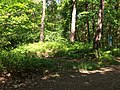
At several points along the hiking trail you come across burial mounds from the Stone and Bronze Ages. Many show traces of destruction in the form of excavations. A group on Stadtweg was excavated and restored in the early 1970s.
Neolithic large stone grave (station 5)
A large stone grave dating from the Neolithic period , which together with the stone chamber was built in the 18th and 19th centuries. Century was completely destroyed. The site was excavated from 1971–1973 by Burchard Sielmann. The burial mound was part of a group of formerly 3 burial mounds and was still 60 cm high. Due to the footprints and tears of the stones, it was possible to reconstruct the ground plan of the grave. Accordingly, the burial mound had a diameter of about 15 m. On the edge of the former burial mound, the remains of around 140 ceramic vessels were found, which were smashed on the large stone grave between 750 and 850 AD by local Saxons as offerings . The large stone grave, which is about 4000 years older, probably served the Saxons as a place of worship .
Location: 53 ° 26 ′ 21.4 ″ N , 9 ° 51 ′ 11.9 ″ E
Burial mound 21 (station 7)
At the foot of the approximately two meter high round hill 21 there are two concentric curb circles. The outer one borders a flat hill, in the center of which was a grave pit sunk into the ground. Nothing was preserved from the burial and its accessories. The type of system allows the conclusion that it is a system of the individual grave culture from the Stone Age. The inner stone circle limits the later elevation of the hill. The discovery of a sheet of bronze and some human foot bones on a stone pavement are the only remains of the Bronze Age burial. A fire pit with charcoal found free on the southern periphery of the hill indicates another burial.
Location: 53 ° 26 ′ 38.4 ″ N , 9 ° 51 ′ 31.1 ″ E
Burial mound 22 (station 8)
The excavation of the probably Bronze Age round hill 22 could only prove the complete destruction of the central burial by a robbery excavation. A crescent-shaped extension on the south side testifies to a later burial in the hill. A subsequent burial in an urn from the pre-Roman Iron Age came to light in the east. Traces of a paving of the entire surface of the hill could be detected and were restored during the restoration.
Location: 53 ° 26 ′ 39.4 ″ N , 9 ° 51 ′ 32.9 ″ E
Reconstruction of Lüllau burial mound 1 (station 9)
At the two burial mounds there is a reconstruction of stone fixtures from a burial mound that was uncovered near Lüllau , southwest of Jesteburg and which could not be preserved at its original location. A curb circle encompasses a hill that was piled up over a tree coffin burial in the older Bronze Age. The only Beifund consisted of an arrowhead from flint . In the younger Bronze Age, a sickle-shaped extension was added to the hill, the stone enclosure of which was also reconstructed. It was used to hold an urn burial, which was protected by a small box made of stone slabs.
Location: 53 ° 26 ′ 38.2 ″ N , 9 ° 51 ′ 32.9 ″ E
Long Hill (Station 11)
In 1976, a 50 m long hill was examined and largely restored. It was initially assumed that there was a stone-age barn bed in the hill , as the marks of a stone border could be found on the edges. However, nine Bronze Age burials were found in the hill. The graves contained body and cremation burials. The unusual facility was probably used for a relatively short period of time. The finds all date from period III of the Bronze Age (according to Montelius). In the east of the long hill there was an area with stone settlements, where fragments of clay vessels were also found. Presumably there was a cult site here that was related to the ritual of the dead.
Location: 53 ° 26 ′ 48.6 ″ N , 9 ° 51 ′ 24.5 ″ E
Reference 6 (station 2)
Site 6 shows the location of an urn cemetery from the pre-Roman Iron Age, of which nothing can be seen above ground. Gustav Schwantes excavated a large number of urn graves here in the 1920s, the oldest of which were provided with stone protection, while this was missing in the youngest. In addition to the corpse burn in the clay pots, he occasionally came across jewelry and clothing accessories, which, however, were often fused beyond recognition in the heat of the pyre. According to the finds, the oldest urn graves were found around 500 BC. Created. With the youngest urns, which came into the earth shortly before the turn of the ages, the approximately 2000-year-old use of the burial place in the Fischbeker Heide ends, apart from the early medieval activities at the megalithic grave.
Location: 53 ° 26 ′ 31.2 ″ N , 9 ° 51 ′ 7.4 ″ E
A small exhibition on the archeology and folklore of the Fischbeker Heide in the Schafstall Information House, Fischbeker Heideweg 43 a, in Neugraben, was designed by the Archaeological Museum Hamburg .
Station 3: Destroyed burial mound from the older Bronze Age Location: 53 ° 26 ′ 27.4 ″ N , 9 ° 51 ′ 2.9 ″ E

Station 10: Bronze Age burial mound Location: 53 ° 26 ′ 38.5 ″ N , 9 ° 51 ′ 33.4 ″ E

Cup from a large stone grave from the Neolithic period


Nearby
The traces of the early medieval fortifications on the Falkenberg are no longer recorded on the archaeological hiking trail, but are not far away. The castle square on the artificially leveled summit plateau of the steeply rising Falkenberg measures 80 × 15 m. The plateau is surrounded by a dry trench about 15 m lower. A bailey followed from here to the northwest. Settlement finds that were made in 1905 when the inn was built on the castle grounds show that the complex was inhabited from the 7th to the 10th century, possibly also into the late Middle Ages . A legend connects the Falkenberg with the pirates Klaus Störtebecker and Gödeke Michels , whose treasures are supposed to be buried there - well guarded by the devil.
literature
- Burchard Sielmann: Archaeological hiking trail in the Fischbeker Heide . In: Hamburgisches Museum für Vor und Frühgeschichte (Hrsg.): Publication of the Helms Museum . No. 28 . Christians, Hamburg 1975, ISBN 3-7672-0354-5 .
- Claus Ahrens: Restored ground monuments in the Harburg area . In: Hammaburg NF . No. 2 , 1975, ISSN 0173-0886 , pp. 71-76 .
Individual evidence
- ↑ a b Claus Ahrens: Restored ground monuments in the Harburg area . In: Hammaburg NF . No. 2 , 1975, ISSN 0173-0886 , pp. 72 .
- ↑ Claus Ahrens: Restored ground monuments in the Harburg area . In: Hammaburg NF . No. 2 , 1975, ISSN 0173-0886 , pp. 74-75 .
- ↑ Friedrich Laux: The stone grave of the Fischbeker Heide . In: Hammaburg NF . No. 14 , 2003, ISSN 0173-0886 , p. 7-177 .
- ↑ a b Claus Ahrens: Work report of the Helms Museum . In: Helms Museum, Hamburg Museum for Archeology and the History of Harburg and the Museum and Heimatverein Harburg-Stadt und -Land eV (Ed.): Harburger Jahrbuch . No. 14, 1973/74 , ISSN 0722-6055 , p. 162-163 .
- ^ Claus Ahrens: Work report of the Helms Museum . In: Helms Museum, Hamburg Museum for Archeology and the History of Harburg and the Museum and Heimatverein Harburg-Stadt und -Land eV (Ed.): Harburger Jahrbuch . No. 12, 1965/67 , ISSN 0722-6055 , p. 131-134 .
- ↑ Klaus Richter: Fischbeker Heide hiking trail on the website of the Archaeological Network Metropolitan Region Hamburg (no longer available)
Web links
- Archaeological hiking trail Fischbeker Heide Archaeological Museum Hamburg