Camp d'Artus
The Celtic oppidum Camp d'Artus, excavated in 1938, is located in the approximately 2500 hectare forest north of the city of Huelgoat ( Breton for "upper forest") in the Finistère department in Brittany in France . Camp d'Artus was a fortified city of the Gallic Osismians , conquered by the legions of Caesar . Its origins are dated to the third century BC.
The English archaeologist Mortimer Wheeler (1890-1976) excavated remains of houses and foundations in the mid-1930s and found similarities to his excavation of Maiden Castle , an Iron Age settlement in England .
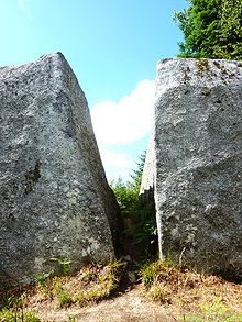
The name Camp d'Artus comes from popular belief and refers to huge granite blocks and remains of fortifications that were believed to be the residence of the legendary King Arthur . The name has been mentioned in documents since the late 18th century.
The facility extends over an area of around 30 hectares on a plateau and consists of two adjacent areas:
- The smaller, more northerly and higher enclosure consists of a Gallic wall . At its northern tip there is a medieval moth originally about 12 meters high , and a gate to the east.
- The lower southern area is formed by a berm about 2 kilometers in circumference.
Nearby are the Dolmen Ti Ar Boutiged , the 8-meter-high menhir du Cloître , the 6-meter-high menhir of Kerampeulven and the 1.55-meter-high menhir d'Artus (also known as "Menhir de la Grotte d'Artus" or Called “Mare aux Sangliers”).
literature
- Cécile Dardignac: Rapport de prospection Archeologique forêt domaniale de Huelgoat . Office National des Forêts, Service Régional de l'Archéologie de Bretagne, Conseil Général du Finistère, December 2009 (French, ovh.net [PDF]).
Individual evidence
- ^ Mortimer Wheeler : The excavation of Maiden Castle, Dorset. First, second and third interim reports . Society of Antiquaries of London , London 1935–1937. (Special prints from: The antiquaries journal. 15, July 1935, 3, ISSN 0003-5815 , pp. 265–275; 16, July 1936, 3, pp. 265–283; 17, July 1937, 3, pp. 261– 282).
- ↑ Jérôme Caouën: Etat des forêts du Roi dans le Poher EN 1784 . Kaier ar Poher, 50, Center Généalogique et Historique du Poher, September 2015
Web links
Coordinates: 48 ° 22 ′ 28.8 " N , 3 ° 44 ′ 36.4" W.


