Ashizuri Uwakai National Park
|
Ashizuri Uwakai National Park
|
||
|
Hoketsu Pass |
||
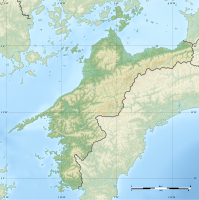
| location | Ehime Prefecture / Kōchi Prefecture , Shikoku | |
| surface | 539.21 km² | |
| WDPA ID | 12399 | |
| Geographical location | 32 ° 46 ' N , 132 ° 38' E | |
|
|
||
| Setup date | November 10, 1972 | |
| administration | Japanese Ministry of Environment | |
The Ashizuri-Uwakai National Park ( Japanese 足 摺 宇 和 海 国立 公園 , Ashizuri-Uwakai Kokuritsu Kōen ) is located in the Shikoku region . The 11,166 hectare national park extends over the prefectures of Ehime and Kōchi . The park was initially founded as a quasi-national park in 1955 , before it was expanded to include the regions in Uwakai in 1972 and declared as the Ashizuri-Uwakai National Park. With the IUCN Category V, the park area is classified as a Protected Landscape / Protected Marine Area .
geography
The park includes stretches of coastline and numerous islands, but also mountainous stretches of up to 1000 m inland. Due to the warm Japanese ocean current, there are also species-rich coral reefs despite the higher latitude.
Flora and fauna
The national park offers a variety of animal and plant species.
- Quercus salicina
- Quercus phillyraeoides
- Machilus thunbergii
- Sciadopitys verticillata
- Cryptomeria japonica
- Tripterospermum japonicum
- Mitrastemonaceae parasites
- Castanopsis Sieboldii
- Livistona chinensis
- Alocasia odora
- Marattiaceae
- Camellia japonica
- Chrysanthemum japonense
- Cirsium maritimum
- Machilus thunbergii
- Fagus crenata
- Abie's company
- Ciadopitys verticillata
- Picea torano
- Rhododendron pentaphyllum var.shikokianum
Notable animal species in the national park include a. Japanese macaques , the white-faced shearwater Calonectris leucomela and the loggerhead turtle , which visit some of the beach sections to lay eggs
Web links
- Ashizuri Uwakai National Park on env.go.jp (English)
- Ashizuri Uwakai National Park Map (PDF)
- World Database on Protected Areas - Ashizuri-Uwakai National Park (English)

