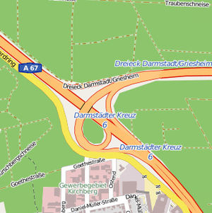
Darmstadt / Griesheim motorway triangle
| Darmstadt / Griesheim motorway triangle | |
|---|---|
|
|
|
| map | |
| location | |
| Country: | Germany |
| State : | Hesse |
| Coordinates: | 49 ° 52 '11 " N , 8 ° 35' 4" E |
| Basic data | |
| Design type: | Trumpet |
| Bridges: | 1 (motorway) |
The Darmstadt / Griesheim motorway triangle is a motorway triangle in the Rhine-Main area and is crossed by around 98,000 vehicles every day. It is an intersection between the A 67 and the A 672 in the urban area of Griesheim, west of Darmstadt .
Traffic volume
| From | To | Average daily traffic volume |
Share of heavy goods traffic |
||||
|---|---|---|---|---|---|---|---|
| 2005 | 2010 | 2015 | 2005 | 2010 | 2015 | ||
| AS Büttelborn (A 67) | AD Darmstadt / Griesheim | 50,000 | 56,300 | 60,400 | 8.3% | 10.1% | 9.7% |
| AD Darmstadt / Griesheim | Darmstädter Kreuz (A 67) | 44,300 | 41,900 | 48,800 | 11.1% | 12.1% | 9.8% |
| AD Darmstadt / Griesheim | AD Darmstadt (A 672) | 22,400 | 21,200 | 23,200 | 5.5% | 4.0% | 3.6% |
Individual evidence
- ↑ Manual road traffic census 2005. (PDF) Results on federal motorways. BASt Statistics, 2007, accessed on August 19, 2018 .
- ↑ Manual road traffic census 2010. (PDF) Results on federal motorways. BASt Statistics, 2011, accessed on August 19, 2018 .
- ↑ Manual road traffic census 2015. (PDF) Results on federal motorways. BASt Statistics, 2017, accessed on August 19, 2018 .
