Reinickendorf motorway junction
| Reinickendorf motorway junction | |
|---|---|
|
|
|
| map | |
| location | |
| Country: | Germany |
| State : | Berlin |
| Coordinates: | 52 ° 33 '55 " N , 13 ° 18' 37" E |
| Basic data | |
| Design type: | Two forks, incomplete cross |
| Bridges: | 1 (motorway) |
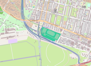
The cross Reinickendorf is a former junction in Berlin Reinickendorf district , which to a junction of the A 111 was redirected. The former A 105 , which crosses the A 111 here, ran east to Kurt-Schumacher-Platz . An extension to the A 103 to Berlin-Steglitz had been planned since 1965, but was given up again. Together with the A 103, the A 105 was to form the Berlin western bypass. Further east of the junction in Berlin-Wedding , the A 105 should cross the A 100 and meet the A 103 in Berlin-Moabit .
In the course of the restructuring during the introduction of the truck toll in 2005, the A 105 was downgraded to an entrance to the A 111 and the Reinickendorf junction was downgraded to the Kurt-Schumacher-Damm junction .
Tegel Airport is located directly to the west of the former cross and the Westhafen to the south .
| From | To | Average daily traffic volume |
|---|---|---|
| AS Seidelstrasse | AS Kurt-Schumacher-Platz | 79,000 |
| AS Kurt-Schumacher-Platz | AS Eichborndamm | 17,800 |
| AS Eichborndamm | AS Kurt-Schumacher-Damm | 85,600 |
Individual evidence
- ↑ Manual road traffic census 2005 (PDF; 0.4 MB) Federal Highway Research Institute, accessed on January 5, 2017 .
