Ayquina
| Ayquina | |
|---|---|
|
Coordinates: 22 ° 16 ′ S , 68 ° 20 ′ W
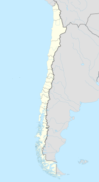
Ayquina on the map of Chile
|
|
| Basic data | |
| Country | Chile |
| region | Antofagasta region |
| Detailed data | |
| height | 2980 m |
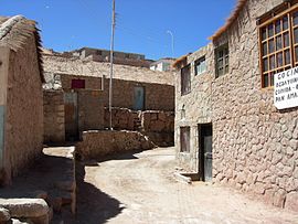
| Street in Ayquina | |
Ayquina (also Aiquina ) is a community in northern Chile . It belongs to the province of El Loa in the Región de Antofagasta .
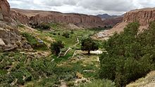
The place is 74 km northeast of Calama at an altitude of 2980 m on the 40 to 50 m high northwest flank of the canyon of the Río Salado . The inhabitants are descendants of the Likanantay and Atacameños .
To the south of the village there are terraced fields provided with irrigation channels for the traditional cultivation of maize , wheat , alfalfa , onions and carrots . In the center of the village is the church of Santuario de Nuestra Señora Guadalupe de Ayquina .
On September 1st, 1998 the place was included in the tentative list of the UNESCO World Heritage together with Toconce because of its cultural importance .
Web links
- Santuario de Nuestra Señora Guadalupe de Ayquina on Chiletur COPEC (Spanish)
Individual evidence
- ↑ a b Ayquina and Toconce. UNESCO, accessed on April 21, 2017 .
- ↑ a b Pueblo de Ayquina y campos de cultivo. Gobierno de Chile, Retrieved April 21, 2017 (Spanish).
- ↑ Nuestra Señora Guadalupe de Ayquina - Calama. Conferencia Episcopal de Chile, accessed August 18, 2019 (Spanish).


