Toconce
| Toconce | |
|---|---|
|
Coordinates: 22 ° 18 ′ S , 68 ° 11 ′ W
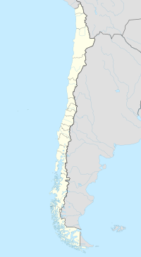
Toconce on the map of Chile
|
|
| Basic data | |
| Country | Chile |
| region | Antofagasta region |
| Residents | 45 |
| Detailed data | |
| height | 3350 m |
| Website | |
Toconce is a municipality with 45 inhabitants in northern Chile near the border with Bolivia . It belongs to the province of El Loa in the Región de Antofagasta .
The place is 91 km northeast of Calama at an altitude of 3350 m on the slopes south of the Toconce River . North of the place, the landscape is dominated by the volcanoes Cerro Paniri , Cerro del León and Toconce .
The village of pre-Columbian origin is characterized by the typical Andean architecture with stone houses and thatched roofs made of cactus wood. On September 1st, 1998 the place was included in the tentative list of the UNESCO World Heritage together with Ayquina because of its cultural importance .
The majority of the residents are farmers who grow corn, potatoes, beans and vegetables on the terraced fields. Together with the neighboring community Caspana is of Toconce the geothermal field of El Tatio managed.
Web links
- Toconce on Ventisca - Cultura, geografía y turismo en El Loa (Spanish)
Individual evidence
- ↑ ALTO EL LOA - Municipalidad de Calama. Retrieved August 11, 2019 (Spanish).
- ↑ Ayquina and Toconce. UNESCO, accessed on August 11, 2019 .
