Babīte
| Babīte | ||
|---|---|---|
 Help on coat of arms |
|
|
| Basic data | ||
| State : |
|
|
| Landscape: | Vidzeme ( Latvian : Vidzeme ) | |
| Administrative district : | Babītes novads | |
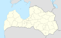
| Coordinates : | 56 ° 57 ' N , 23 ° 57' E | |
| Residents : | 1,230 | |
| Area : | ||
| Population density : | ||
| Height : | ||
| Website: | www.babite.lv | |
| Post Code: | ||
| ISO code: | ||
Babīte (German Babbit ) is a place in Latvia , which is located 13 kilometers west of the center of Riga .
The place is located in the catchment area of Riga and at times also belonged administratively to this city. Nearby is a medieval castle hill (Latin: Castrum Babat, popularly Polish hill). An army camp was located here during the Northern War .
Babītes novads
In 2009, when the municipality of Sala was incorporated into the new administrative structure of Latvia, the Babītes novads district was created . The administrative center of the district is located in Piņķi.
literature
- Hans Feldmann , Heinz von zur Mühlen (Hrsg.): Baltic historical local dictionary, part 2: Latvia (southern Livland and Courland). Böhlau, Cologne 1990, ISBN 3-412-06889-6 , p. 49.
- Astrīda Iltnere (ed.): Latvijas Pagasti, Enciklopēdija. Preses Nams, Riga 2002, ISBN 9984-00-436-8 .
