Baker Lake (Lake in Nunavut)
| Baker Lake / Qamani'tuaq | ||
|---|---|---|

|
||
| Satellite image of Baker Lake - the mouths of the Thelon River (in the west) and Kazan River (in the south), as well as the outflow to Chesterfield Inlet (in the east) are clearly visible | ||
| Geographical location | Kivalliq Region in Nunavut (Canada) | |
| Tributaries | Thelon River , Kazan River | |
| Drain | to Chesterfield Inlet | |
| Places on the shore | Baker Lake | |
| Data | ||
| Coordinates | 64 ° 9 ′ N , 95 ° 30 ′ W | |
|
|
||
| Altitude above sea level | 2 m | |
| surface | 1 783 km² | |
| length | 96 km | |
| width | 27 km | |
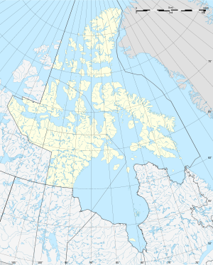
Baker Lake ( Inuktitut : Qamani'tuaq ; "where the river widens") is a lake in the Kivalliq region of the Canadian territory of Nunavut . It is located about 150 km west of the northwest coast of Hudson Bay .
The Thelon River flows into Baker Lake from the west and the Kazan River from the south . Its outflow leads over two broad arms ( North Channel and South Channel ) to the nearby Chesterfield Inlet , a long and narrow inlet of Hudson Bay . The water surface of the Baker Lake is 1783 km ², including islands it is 1887 km ². The water level is only 2 m above sea level.
The Inuit settlement Baker Lake is located at the western end of the lake near the mouth of the Thelon River. In 1915 a post of the Royal Canadian Mounted Police was established at the eastern end of the lake . A year later a trading post of the Hudson's Bay Company followed near the mouth of the Kazan River delta. In 1930 this trading post moved to its current location.
fauna
The Beverly and Qamanirjuaq herds of caribou live in the area around the lake .
Web links
- Hamlet of Baker Lake
- The Atlas of Canada - Lakes of Nunavut ( Memento from January 14, 2013 in the Internet Archive )
Individual evidence
- ↑ a b c The Atlas of Canada - Lakes ( Memento from January 14, 2013 in the Internet Archive ) (English)
