Basento
|
Basento Vasento, ancient: Masuentum |
||
|
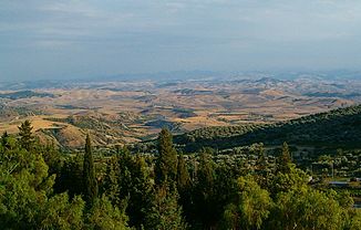
View of the Basentotal |
||
| Data | ||
| location | Basilicata , southern Italy | |
| River system | Basento | |
| River basin district | Appennino Meridionale | |
| Source height | 1722 m slm | |
| muzzle | at Lido di Metaponto in the Gulf of Taranto Coordinates: 40 ° 20 ′ 15 ″ N , 16 ° 49 ′ 6 ″ E 40 ° 20 ′ 15 ″ N , 16 ° 49 ′ 6 ″ E |
|
| Mouth height | 0 m slm | |
| Height difference | 1722 m | |
| Bottom slope | 12 ‰ | |
| length | 149 km | |
| Catchment area | 1537 km² | |
The Basento ( Vasento, Masuentum ) is the longest river in the southern Italian region of Basilicata . The river has its source on Monte Arioso in the Lucanian Apennines , flows mainly in an east-southeast direction over the provincial capital Potenza and further over Trivigno and flows into the Gulf of Taranto after a run of 149 km at Lido di Metaponto (municipality of Bernalda ) . For most of his run he is accompanied by the Battipaglia – Metaponto railway line and the well-developed Italian Strada Statale 407 Basentana ( European route 847 ).
Tributaries
The Camastra flows into the Basento from the right, the Tiera and the Lavannarello flow from the left .
