Bastam (West Azerbaijan)
| Bastam | ||
|---|---|---|
|
|
||
| Basic data | ||
| Country: |
|
|
| Province : | West Azerbaijan | |
| Coordinates : | 38 ° 53 ' N , 44 ° 57' E | |
| Height : | 1300 m | |
| Time zone : | UTC +3: 30 | |
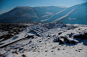
Bastam ( Persian بسطام, DMG Basṭām ; Urartian Rusai URU.TUR) is a main Urartian fortress from the 7th century BC. It is named after the nearby village and is located in the Iranian province of West Azerbaijan .
location
Bastam is located in the far northwest of Iran, 50 km north of the city of Choy and close to the borders with Turkey and the Nakhchivan Autonomous Republic . According to calculations in 2012, the city had 7881 inhabitants.
The ancient fortress is located on a rocky ridge 1,300 m above sea level high above the modern village on the left bank of the Aq-Çay. The latter served to irrigate the fertile Qara Zia ed-Din plain via a canal system in Urartian times. In addition to controlling the adjacent plain, the fortress was also used to secure the east-west connection between the capital Tušpa (now Van ) and the Urartian regions in what is now Azerbaijan and Armenia .
history
As excavations in the area of the village have shown, Bastam was already in the 3rd millennium BC. Settled. In the 9th century BC The area became part of the Urartian Empire . At that time a small fortress was built, which later had to give way to the citadel . Bastam only gained importance in the first half of the 7th century BC. When the Urartian king Rusa II reorganized his kingdom. Among the residences of Ayanıs , Kefkalesı and Karmir Blur , Bastam was by far the strongest fortress. After Tušpa , Bastam was the largest Urartian fortress ever. Nevertheless, the fortress was probably conquered by the Scythians during the rule of Rusa , burned down and not rebuilt.
Discovery and excavation
First information about the fortress comes from an inscription on a foundation, supposedly from the village of Bastam, published in 1910. The actual place of origin was only discovered in 1967 by Wolfram Kleiss from the German Archaeological Institute , Tehran branch . Kleiss led the excavations of the DAI in 1969 and 1978. In 1999 the Iranian Organization for Cultural Heritage (ICHO) continued the excavations.
The fortress extends over an area of about 800 by 400 BC. m and is divided into a lower, middle and upper citadel. The defensive walls are lined with rectangular towers and pillars. All buildings are made of dried mud bricks on high stone foundations. The royal residence was in the upper citadel around 150 BC. m above the level. When some rooms were uncovered, fragments of painted plaster were found.
Grape seeds, almonds, apricots, linden fruits, cereals, legumes, millet and sesame were found on botanical remains.
literature
- Wolfram Kleiss: Bastam / Rusa-i-Uru.Tur: Description of the Urartean and medieval ruins . (Berlin: D. Reimer 1977) Guide to archaeological sites in Iran 1.
- Bastam (Berlin: Mann 1979–1988), Teheraner Research 4–5.
- Wolfram Kleiss: Bastam, an Urartian citadel complex of the Seventh Century BC . American Journal of Archeology 84/3, 1980, 299-304.
Web links
- Bastam (West Azerbaijan) . In: Ehsan Yarshater (Ed.): Encyclopædia Iranica (English, including references)
- Full Page of Stephan Kroll to the excavations (English)
Individual evidence
- ↑ Population statistics 2012. (No longer available online.) Archived from the original on April 2, 2015 ; Retrieved October 27, 2013 . Info: The archive link was inserted automatically and has not yet been checked. Please check the original and archive link according to the instructions and then remove this notice.
- ↑ Hopf, M., Willerding, U., 1988. Plant residues. In: W. Kleiss (Ed.), Bastam II, excavations in the Urartean complexes 1977–1978. Gebr. Mann Verlag Berlin, 1988, 263-318.


