Bawakaraeng
| Bawakaraeng | ||
|---|---|---|
| height | 2830 m | |
| location | Sulawesi ( Indonesia ) | |
| Coordinates | 5 ° 19 '2 " S , 119 ° 56' 38" E | |
|
|
||
| Type | Extinct volcano | |
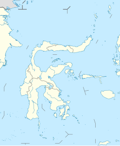
The Bawakaraeng is a 2,830-meter-high extinct volcano on the Indonesian island of Sulawesi . It is located around 80 kilometers southeast of Makassar in the Sulawesi Selatan province in the district ( Kabupaten ) Gowa . The mountain is also the headwaters of the Jeneberang .
mythology
Bawakaraeng has its own meaning for the surrounding communities. Bawa means mouth, Karaeng means God. So the mouth of God. There are also pilgrimages to the mountain.
landslide
On March 26, 2004, a landslide of 235 million m³ of earth occurred when part of the eastern flank of the mountain's caldera slid into the Jeneberang River . 30 people were killed. The annual sedimentation is also a problem for the Bilibili Reservoir , which is gradually filling and which is the main water supply to the Makassar and Gowa area.
Individual evidence
- ↑ Hajat Jutaan Jiwa Ada di Tangan Mereka ( Memento of the original from March 10, 2011 in the Internet Archive ) Info: The archive link was inserted automatically and has not yet been checked. Please check the original and archive link according to the instructions and then remove this notice. , on March 9, 2011 in Jafar Online. Retrieved June 5, 2011
- ↑ Report on the Large-Scale Landslide at Mt. Bawakaraeng in Sulawesi , manuscript for the journal of “SABO”
