Bayershof
|
Bayershof
Weilar municipality
Coordinates: 50 ° 45 ′ 1 ″ N , 10 ° 6 ′ 56 ″ E
|
|
|---|---|
| Height : | 490 m above sea level NN |
|
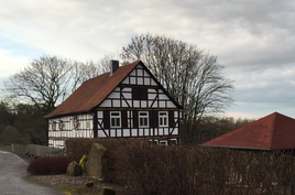
View of the Bayershof (2016)
|
|
Bayershof is a remote farm in the Weilar district in the Wartburg district in Thuringia .
The geographic height of the place is 490 m above sea level. NN . The Bayershof was first mentioned in a document on November 1st, 1335. Until 1802 he belonged to the imperial-free rule Lengsfeld .
On September 30, 2009, 3 people lived in the village.
Web links
Commons : Bayershof - collection of images, videos and audio files
Individual evidence
- ↑ Official topographic maps of Thuringia 1: 10,000. Wartburgkreis, district of Gotha, district-free city of Eisenach . In: Thuringian Land Survey Office (Hrsg.): CD-ROM series Top10 . CD 2. Erfurt 1999.
- ^ Wolfgang Kahl : First mention of Thuringian towns and villages. A manual. Rockstuhl Verlag, Bad Langensalza, 2010, ISBN 978-3-86777-202-0 , p. 26
- ↑ Information .. In: District Office Wartburgkreis (Hrsg.): Official Gazette of the Wartburgkreis from 10 August 2010 . Bad Salzungen 2010, p. 14 .
