Ben Arthur
| Ben Arthur | ||
|---|---|---|
| height | 884 m ASL | |
| location | Arrochar Alps | |
| Mountains | Grampian Mountains | |
| Notch height | 256 m | |
| Coordinates | 56 ° 12 '43 " N , 4 ° 48' 39" W | |
|
|
||
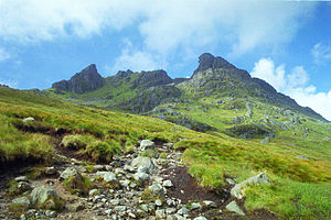
The Ben Arthur ( Gaelic : Beinn Artair ) is a 884 meter high mountain in Scotland , at the foot of which lies Loch Long . Commonly known as The Cobbler , it is located in the Arrochar Alps west of Loch Lomond in the Strathclyde region of southern Scotland. It is classified as a Corbett , but is nevertheless one of the most impressive peaks in the southern Highlands . The formation of the summit is attributed to large-scale landslides and not to glacial activity.
The summit section of the Cobbler consists of three individual peaks, with the middle one being the highest. The peaks can be reached via the “Buttermilk Burn” stream. Usually, the main summit is climbed through a small cave passage ("window" climbing) called The Needle .
The rock has mica slate ( mica group ), which causes a high risk of slipping when wet. Hunting areas have always been located at the foot of the mountain. The mountain is also known for its view of the more important Ben Lomond on the east side of Loch Lomond.
literature
- Cameron McNeish, Roger Smith: Hiking in Scotland . Scheuble & Baumgartner, 1989, ISBN 3-924852-06-5 (travel literature).
Individual evidence
- ↑ The Cobbler (Corbett)
- ↑ David Jarman, The Cobbler - a mountain shaped by rock slope failure , Scottish Geographical Journal 120, 227-40 (2004)
- ↑ Chris Townsend, The Cobbler, Scotland , Cicerone Press. P. 106 f. (2011) ISBN 9781852844424 .
- ↑ Sandra Bardwell, Loch Lomond and the Trossachs National Park, Walking in Scotland , Walking Guides, 2nd Edition, Lonely Planet, pp. 102-110 (2007) ISBN 9781741042030 .

