
Bernadeinkopf
| Bernadeinkopf | ||
|---|---|---|
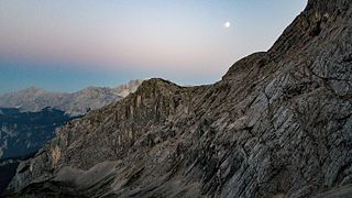
 Bernadeinkopf from the southwest from the Oberkar |
||
| height | 2143 m | |
| location | Bavaria , Germany | |
| Mountains | Wetterstein Mountains | |
| Coordinates | 47 ° 25 '48 " N , 11 ° 3' 32" E | |
|
||
| Development | Via ferrata | |

The Bernadeinkopf is a 2143 m high mountain in the Alpspitze massif in the Wetterstein Mountains in Bavaria . He is known for the via ferrata called Mauerläufersteig , which leads through its north face.
Location and surroundings
The Bernadeinkopf lies to the east below the eastern ridge of the Alpspitze, which continues further east in the Bernadeinwwall . While the north side is characterized by steep rock faces, the Bernadeinkopf is relatively flat on the south side and drops with moderate inclines to the 1921 m high Stuibensee .
ways
Through the steep north faces a lead Nice course called alpine climb. The south side of the mountain above the Stuibensee is also accessible by hiking trails. From the south, the Bernadeinkopf can also be climbed as a ski tour in winter .
The Mauerläufersteig is a via ferrata of difficulty level D-E opened in summer 2009 . It leads almost vertically from around 1900 m at the foot of the Bernadein north face over around 400 meters of climbing to the summit of the Bernadeinkopf. The path has almost no artificial steps. 400 meters of steel cable are sometimes stretched so far in front of the rock that the effect of overhangs is created. The via ferrata was built on behalf of the Bayerische Zugspitzbahn Bergbahn AG , from whose mountain station on the Osterfelderkopf the entrance can be reached in half an hour. To return from the summit of the Bernadeinkopf, choose the Nordwandsteig or walk over the scree fields of the Schöngang back to the Osterfelderkopf. Appropriate alpine equipment ( via ferrata set and helmet ) and appropriate footwear are required. You can stop off at the restaurant at Osterfelderkopf at 2030 m .
map
- BLVA UK L 31, Werdenfelser Land (1: 50,000)
Image gallery

Bernadeinwand, right next to the Alpspitze
Bernadeinwand in the sunset

Summit cross


Web links
- Wall runner via ferrata , tour description with lots of photos and GPS track on via-ferrata.de
- sueddeutsche.de: "tightrope act on the mountain"
- Surrounding / panoramic situation map
Individual evidence
- ↑ Bernadeinkopf / Ski Tour. In: alpintouren.com. Retrieved August 17, 2010 .