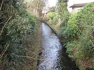
Beverley Brook
| Beverley Brook | ||
|
The Beverly Brook and the Pyl Brook |
||
| Data | ||
| location |
London Borough of Merton , Royal Borough of Kingston upon Thames , London Borough of Richmond upon Thames , London Borough of Wandsworth England |
|
| River system | Thames | |
| Drain over | Thames → North Sea | |
| source | in Cuddington Park 51 ° 22 ′ 10 ″ N , 0 ° 14 ′ 30 ″ W. |
|
| muzzle | in the Thames Coordinates: 51 ° 28 ′ 21 ″ N , 0 ° 13 ′ 25 ″ W 51 ° 28 ′ 21 ″ N , 0 ° 13 ′ 25 ″ W.
|
|
| length | 14.3 km | |
| Catchment area | 64 km² | |
| Left tributaries | Coombe Brook | |
| Right tributaries | Pyl Brook | |
|
The Beverley Brook in Barnes |
||
The Beverley Brook is a watercourse in Greater London . It will be built in Cuddington Park in the London Borough of Merton and will then run underground to Worcester Park, east of Worcester Park Station . It flows in a northerly direction and initially forms the border between Wimbledon Common in Merton and Coombe and the Royal Borough of Kingston upon Thames . It crosses Richmond Park and then represents the border between East Sheen and the London Borough of Richmond upon Thames and Roehampton and the London Borough of Wandsworth . After passing under the Hounslow Loop Line , east of Barnes Bridge Station , Beverley Brook turns east to meet the Thames at Barnes on the border of Richmond upon Thames and Wandsworth.
Web links
- Beverley Brook Walk on the London Borough of Merton
- Environment Agency , Beverley Brook Information Pack
- Beverley Brook on London's Lost Rivers

