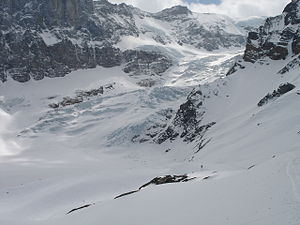
Bifertenfirn
The Bifertenfirn is a valley glacier at the end of the Grosstal, in the Glarus Alps , in the Canton of Glarus in Switzerland . It has a length of 4.4 km with an average width of 500 m and an area of 2.8 km².
The Bifertenfirn has its origin on the summit of the Tödi at 3600 m above sea level. M. First, flows of glaciers to the south, but then takes a sharp bend and move further to the east, then to the northeast. It is accompanied to the south by the steep rock faces of Piz Urlaun ( 3359 m above sea level ), Bündner Tödi ( 3124 m above sea level ) and Bifertenstock . The glacier slope is 30 to 40% in the steep upper part and less than 20% in the lower part. The glacier tongue ends just below 2000 m . The melt water is led away from the Bifertenbach , which together with the Oberstafelbach forms the Sandbach , which is a source brook of the Linth .
Since the high stage during the Little Ice Age around the middle of the 19th century, the Bifertenfirn has retreated a little more than 500 m. On a ridge directly on the north side of the glacier stands at 2448 m above sea level. M. the Grünhornhütte of the Swiss Alpine Club SAC. It was the club's first hut after the SAC was founded in 1863. Today it is a museum. The SAC's Fridolinshütte, a little below, serves as the starting point of the Tödi .
Coordinates: 46 ° 48 ′ 12 " N , 8 ° 55 ′ 42" E ; CH1903: seven hundred thirteen thousand seven hundred ten / 184654
