Bindalsfjord
| Bindalsfjord | ||
|---|---|---|
|
Tosen in Brønnøy |
||
| Waters | European Arctic Ocean | |
| Land mass | Scandinavian peninsula | |
| Geographical location | 65 ° 13 ' N , 12 ° 10' E | |
|
|
||
| length | 26 km | |
| Islands | Øksninga, Hovøya, Stavøya, Imøya | |
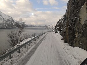
The Bindalsfjord is a fjord in the municipalities of Bindal and Sømna in Nordland in Norway . The fjord stretches 17 km to the northeast and then southeast to the island of Øksninga . At Øksninga the fjord divides into two arms, Tosenfjord ( Norwegian Tosen ) and Sørfjord . The Tosenfjord leads to the northeast, while the Sörfjord leads to the southwest. It is 66 km from Solstad to Tosen.
The mouth of the fjord lies between Holm in the south and Vennesund in the north. There is a ferry connection between these two places on the Fv17 coastal road . At the Gavlen peninsula, halfway into the fjord, the Ursfjord branches off to the north. The island of Hovøya is just east of Gavlen and the Hardangsfjord begins at this point . To the southeast of Gavlen are the islands of Stavøya and Imøya. To the east of these is the Skotnesfjord .
At Øskinga the Reppsund ( Norwegian Reppsundet ) branches off on the north side of the island and leads to the mouth of the Tosenfjord. On the southwest side of Øksninga lies the Terråkfjord , while the Øyfjord lies on the southeast side between the mouth of the Tosenfjord and the Sørfjord.
Regional road 6 ( Norwegian Fylkesvei 6 ) runs along the west bank of Fjrods. There is also the hamlet of Skjelsviksjøen.
Remarks
- ↑ The Norwegian Wikipedia (Bokmål) has an article on Terråkfjorden .

