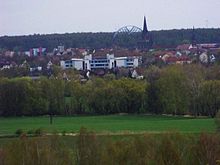
Bitterfeld bow
| Bitterfeld bow | |
|---|---|

|
|
| Bitterfeld bow | |
| Basic data | |
| Place: | Bitterfeld , Germany |
| Construction time : | 2005-2006 |
| Status : | Built |
| Architectural style : | Modern |
| Architect : | Claus Bury |
| Use / legal | |
| Owner : | City of Bitterfeld-Wolfen |
| Technical specifications | |
| Height : | 28 m |
The Bitterfeld Arch is a structure in the form of a steel arch bridge . It is an architectural sculpture designed by the Frankfurt artist Claus Bury on a former high point , the so-called Bitterfelder Berg, above the newly created cultural and lake landscape of the Bitterfeld region . The building, which was built between 2005 and 2006 and is 81 m long, 14 m wide and 28 m high, is used as a viewing point . The arch is a new landmark of the city of Bitterfeld-Wolfen , which also uses this motif for its logo .

The arch construction is based on two pointed oval wing shapes placed diagonally to one another and staggered downwards in three ways. A ramp system with a 6 ° slope is suspended in the two spaces. The two pairs of wings of the overall architecture are clearly inclined inwards, which gives the arch both additional elegance and static strength. The above-mentioned ramps lead in a long zigzag course two by five footpaths made of non-slip and close-meshed galvanized steel grates upwards. All paths are stepless and secured by metal railings made of narrow, rhythmic bar grids. Every bend in the 540 meter long hiking trail has a small platform including a bench. The top ramp ends in a balcony that protrudes 21 meters above the arch and invites you to linger high above Bitterfeld.
Bitterfelder Bogen is also the title of a report by Monika Maron from 2009. In 1981 she described the city of Bitterfeld as the dirtiest city in Europe in her debut novel Flugasche about the newly established Q-Cells solar cell factory.
Web links
- "Welcome to Bitterfeld-Wolfen - Enter the Bitterfeld Arch" ( Memento from September 10, 2011 in the Internet Archive )
- Bitterfelder Bogen on goitzsche-tourismus.de
- Bitterfeld bow. In: Structurae
Individual evidence
- ↑ Bitterfelder Bogen on goitzsche-tourismus.de
Coordinates: 51 ° 36 ′ 54.8 " N , 12 ° 19 ′ 33.8" E