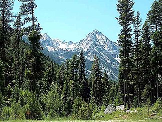
Bitterroot Mountains
| Bitterroot Mountains | ||
|---|---|---|
|
Trapper Peak in the Bitterroot Mountains |
||
| Highest peak | Trapper Peak ( 3096 m ) | |
| location | Idaho , Montana (USA) | |
| part of | Bitterroot chain | |
|
|
||
| Coordinates | 46 ° 2 ′ N , 114 ° 24 ′ W | |
The Bitterroot Mountains are part of the larger Bitterroot chain and lie between the US states of Idaho and Montana . The mountain range extends from the Lookout Pass 200 miles southeast to the Lost Trail Pass . The area covers an area of 16,513 km² and is bounded to the north by Lolo Creek , to the south by the Salmon River , to the west by the Selway and Lochsa rivers and to the east by the Bitterroot Valley . The highest mountain is the Trapper Peak with 3096 m .
swell
- ↑ Bitterroot Mountains on bivouac.com (English)
Web links
Commons : Bitterroot Mountains - Collection of images, videos and audio files
- Bitterroot Mountains in the United States Geological Survey's Geographic Names Information System
- Central Bitterroot Range on Peakbagger.com (English)
- Northern Bitterroot Range on Peakbagger.com (English)

