Selway River
| Selway River | ||
| Data | ||
| Water code | US : 390102 | |
| location | Idaho ( USA ) | |
| River system | Columbia River | |
| Drain over | Middle Fork Clearwater River → Clearwater River → Snake River → Columbia River → Pacific Ocean | |
| Headwaters | East flank of Stripe Mountain , Clearwater Mountains 45 ° 29 ′ 49 ″ N , 114 ° 44 ′ 37 ″ W |
|
| Source height | approx. 2100 m | |
| Association with |
Lochsa River to Middle Fork Clearwater River Coordinates: 46 ° 8 ′ 25 " N , 115 ° 35 ′ 58" W 46 ° 8 ′ 25 " N , 115 ° 35 ′ 58" W |
|
| Mouth height | 443 m | |
| Height difference | approx. 1657 m | |
| Bottom slope | approx. 10 ‰ | |
| length | approx. 160 km | |
| Catchment area | approx. 5210 km² | |
| Discharge at the gauge above Moose Creek A Eo : 2556 km² Location: 50 km above the mouth |
MQ 1996/2005 Mq 1996/2005 |
49 m³ / s 19.2 l / (s km²) |
| Discharge A Eo : 4960 km² Location: 12 km above the mouth |
MQ 1930/2017 Mq 1930/2017 |
93 m³ / s 18.8 l / (s km²) |
| Left tributaries | Meadow Creek | |
| Right tributaries | Deep Creek, White Cap Creek, Bear Creek, Moose Creek | |
| National Wild and Scenic River | ||
|
Map with Lochsa River |
||
|
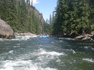
Goat Creek Rapid on the Selway River |
||
The Selway River is the roughly 160 km long headwaters of the Middle Fork Clearwater River in the US state of Idaho .
River course
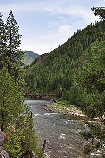
The Selway River rises on the eastern flank of Stripe Mountain ( 2,744 m ) in the Clearwater Mountains in northeast Idaho. From there it initially flows 100 km north. The Bitterroot Mountains rise east of the upper reaches. The river initially flows through the Bitterroot National Forest , later through the Nez Perce National Forest . The Selway-Bitterroot Wilderness Area extends over part of the catchment area. The Moose Creek from the Bitterroot Mountains flows from the northeast into the Selway River. This then turns to the west. It finally unites at Lowell with the Lochsa River to form the Middle Fork Clearwater River. The entire course of the river was added to the National Wild and Scenic River System in 1968. One section of the river on the upper reaches and one on the middle reaches the wild , the rest are classified as recreational .
Hydrology
The Selway River drains an area of 5210 km². The mean discharge 12 km above the mouth is 93 m³ / s. During the melting of the snow in May, the river carries the largest amounts of water with an average of 377 m³ / s.
leisure
Between White Cap Creek and Selway Falls there is a 75 km long stretch of river with rapids up to difficulty level IV. In June and July in particular, the water conditions of the Selway River are suitable for white water activities.
Web links
- Selway Wilderness at Three Rivers Lowell, Idaho
Individual evidence
- ↑ a b Lochsa River in the Geographic Names Information System of the United States Geological Survey
- ↑ a b c USGS 13336500 SELWAY RIVER NR LOWELL ID
- ^ A b Clearwater River (Middle Fork), Idaho . National Wild and Scenic Rivers System. Retrieved August 25, 2018.


