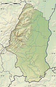
Blauenberg
| Blauenberg | ||
|---|---|---|
| height | 680 m | |
| location | Haut-Rhin department , Grand Est region , France | |
| Mountains | law | |
| Coordinates | 47 ° 27 '49 " N , 7 ° 20' 4" E | |
|
|
||
The Blauenberg is a mountain ridge more than two kilometers long in the French Jura . It forms the municipal boundary between Kiffis and Lutter in the canton of Ferrette . The highest point is at the western end at 680 m.
