Blindsee (Tyrol)
| Blindsee | ||
|---|---|---|

|
||
| Geographical location | Tyrol , Austria | |
| Tributaries | Roßköpfle waterfall (northwest) | |
| Location close to the shore | Biberwier | |
| Data | ||
| Coordinates | 47 ° 21 '45 " N , 10 ° 50' 50" E | |
|
|
||
| Altitude above sea level | 1093 m above sea level A. | |
| surface | 22 ha | |
| length | 1.1 km | |
| width | 600 m | |
| volume | 3 to 4 million m³ | |
| scope | 3.6 km | |
| Maximum depth | 25 m | |
| Middle deep | 10 to 14 m | |
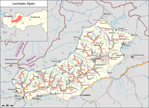
The Blindsee is a mountain lake in the border area of the Lechtal Alps and the Mieminger Mountains north below the Fernpass in Tyrol .
location
The lake is 1093 m above sea level. A. around 3 kilometers southwest of Biberwier (as the crow flies ), on whose municipality it is completely located. It is up to 25 meters deep. The Fernpassstraße leads past the southern part of the lake, which , coming from the Fernpass, leads north over the Lermoos tunnel to Lermoos . The Zugspitze, around 16 km to the north, can be seen from the lake .
The lake has no surface runoff and is therefore a blind lake , which is probably what gave it its name.
Emergence
Like the entire valley floor relief of the Fernpass itself, the Blindsee was created by a massive landslide around 4,100 years ago. In the depressions between the landslide hills, the Fernpass lakes were formed by the influx of surface or spring water.
tourism
The Blindsee, which is privately owned by a hotel in Lermoos, is particularly suitable for diving because of its very clear water (with visibility of up to 30 meters) and the abundance of fish . In February 1984, after heavy snowfall, a slope on the north side of the Blindsee fell. Trees, branches and roots spread out over the ice surface of the frozen lake, which collapsed a little later. The numerous tree trunks sunk in the process make for a special underwater experience.
There is a swimming area at the north-eastern foothills of the lake, and the nearby car park can be reached from the Fernpassstraße on a narrow toll road. The water of the lake warms up to 24 ° C on the surface in midsummer .
A hiking trail leads around the water near the shore.
Web links
Individual evidence
- ↑ Determination of the age of the Fernpass landslide
- ↑ Automatic barriers regulate the rush at Blindsee , Tiroler Tageszeitung from July 18, 2015
