Bonriki
| Bonriki | ||
|---|---|---|
| Tarawa with Bonriki Airport | ||
| Waters | Pacific Ocean | |
| Archipelago | Tarawa -Atoll | |
| Geographical location | 1 ° 22 '20 " N , 173 ° 9' 9" E | |
|
|
||
| length | 8.1 km | |
| width | 3 km | |
| surface | 9.912 km² | |
| Residents | 12,988 (2005) 1310 inhabitants / km² |
|
| main place | Bikenibeu | |
| Bonriki is the easternmost of the South Tarawas islands | ||
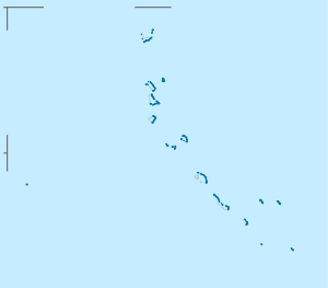
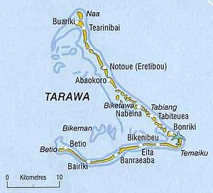
Bonriki is an island in the district of South Tarawa the atoll of Tarawa . It is located at the eastern end of the main atoll of the island state of Kiribati . The place of the same name is located in the northwest of the island. The elongated island includes Bikenibeu in the west . Bikenibeu is also the largest of the five towns on the island.
Bonriki International Airport is also located on Bonriki .
To the north of the island of Bonriki lies the island of Tanaea, which is also part of the South Tarawa district, and a few smaller islands. The next island further north, Buota , already belongs to the more rural district of North Tarawa . To the west follows the neighboring island of Eita, with which Bonriki is connected via a road embankment.
| place | 1978 | 2005 |
|---|---|---|
| Bonriki | 635 | 2.119 |
| Temwaiku | - | 2.011 |
| Causeway | - | 1,780 |
| Bikenibeu | 3,971 | 6,170 |
| Abarao | 322 | 908 |
| Bonriki Island | 4,928 | 12,988 |
Climate table
| Bonriki | ||||||||||||||||||||||||||||||||||||||||||||||||
|---|---|---|---|---|---|---|---|---|---|---|---|---|---|---|---|---|---|---|---|---|---|---|---|---|---|---|---|---|---|---|---|---|---|---|---|---|---|---|---|---|---|---|---|---|---|---|---|---|
| Climate diagram | ||||||||||||||||||||||||||||||||||||||||||||||||
| ||||||||||||||||||||||||||||||||||||||||||||||||
|
Average monthly temperatures and rainfall for Bonriki
Source: wetterkontor.de
|
|||||||||||||||||||||||||||||||||||||||||||||||||||||||||||||||||||||||||||||||||||||||||||||||||||||||||||||||||||||||||||||||||||||||||||||||||||||||||||||||||||||||||||||||||||||||||||||||||||
Individual evidence
- ^ Report of the 1978 Census of Population and Housing. Republic of Kiribati 1980, Vol. 1, pp. 6-7
- ↑ Kiribati 2005 Census of Population and Housing. Provisional tables. + (Accessed March 29, 2010)


