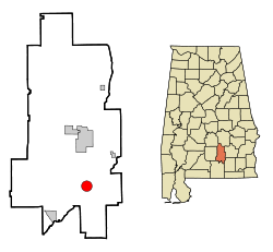
Brantley, Alabama
| Brantley | |
|---|---|
 In the Brantley Historic District (2012) |
|
| Location in Alabama | |
| Basic data | |
| State : | United States |
| State : | Alabama |
| County : | Crenshaw County |
| Coordinates : | 31 ° 35 ′ N , 86 ° 15 ′ W |
| Time zone : | Central ( UTC − 6 / −5 ) |
| Residents : | 809 (as of 2010) |
| Population density : | 98.7 inhabitants per km 2 |
| Area : | 8.2 km 2 (approx. 3 mi 2 ) of which 8.2 km 2 (approx. 3 mi 2 ) is land |
| Height : | 90 m |
| Postal code : | 36009 |
| Area code : | +1 334 |
| FIPS : | 01-09016 |
| GNIS ID : | 0154995 |
| Website : | www.townofbrantley.com |
Brantley is a city in Crenshaw County in the US state of Alabama . According to the 2010 census, Brantley had 809 residents. It is the hometown of former NBA basketball player Chuck and his brother Wesley Person .
geography
Brantley is located in southern Alabama in the southern United States. It is located approximately 42 kilometers north of the 339 square kilometers Conecuh National Forest .
Nearby places include Luverne (9 km north), Dozier (10 km south-west), Glenwood (10 km north-east), Goshen (16 km north-east) and Elba (19 km south-east). The next larger city is the capital of Alabama, Montgomery, about 76 kilometers to the north with 212,000 inhabitants .
history
In 1890 the Central of Georgia Railway built a railway line from Troy to Searight . A group of investors led by Thomas K. Brantley then bought land to build a new town. The city limits were each set up 3 miles from the city center, which explains the city's circular shape. The city was incorporated as early as 1891 and received a post office. The town's first name was Sasserville , later it was renamed Marcus and finally Brantley .
Brantley's economy was shaped early on by the timber and textile industries.
With the Brantley Historic District , Brantley has an entry in the National Register of Historic Places (as of July 13, 2019).
traffic
US Highway 331 and Alabama State Route 15 lead from the north into the town on the same route , in the city center they are divided: Alabama State Route 15 runs west, US Highway 331 south. There is a connection to US Highway 29 13 kilometers north, and US Highway 84 30 kilometers south .
Troy Municipal Airport is approximately 37 kilometers northeast , and Mac Crenshaw Memorial Airport is 43 kilometers northwest .
Demographics
According to the 2000 census , Brentley had 920 residents, spread across 406 households and 261 families. The population density was 112.5 inhabitants / km². 59.35% of the population were white and 40.22% were African American. Children under the age of 18 lived in 28.8% of households. The median income per household was $ 21,574, with 24.6% of the population living below the poverty line .
By the 2010 census , the population had dropped to 809.
Personalities
- Chuck Person (* 1964), former basketball player
Web links
- Official website (English).
- Statistical data on Brantley (Engl.)
- Brantley in the Encyclopedia of Alabama (Engl.)
Individual evidence
- ^ Website of the US Census Bureau
-
↑ Search mask database in the National Register Information System. National Park Service , accessed July 13, 2019.
Weekly List on the National Register Information System. National Park Service , accessed July 13, 2019.
