Bratina lagoon
| Bratina lagoon | ||
|---|---|---|
|
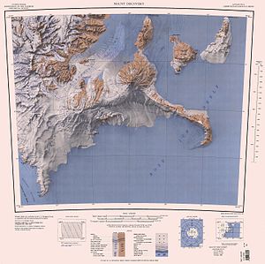
Topographic map (1: 250,000) with the unlabeled Bratina lagoon on the northern tip of the Brown Peninsula (top center) |
||
| Waters | Ross Sea | |
| Land mass | Victoria Land , East Antarctica | |
| Geographical location | 78 ° 1 ′ 0 ″ S , 165 ° 30 ′ 0 ″ E | |
|
|
||
| width | 250 m | |
| depth | 700 m | |
The Bratina Lagoon is a tidal , 700 m long and 250 m wide lagoon on the Scott coast of the East Antarctic Victoria Land . The bay , criss-crossed by sandbanks , ponds and troughs , is located on the northern tip of the Brown Peninsula . In front of it is the island of Bratina Island .
The New Zealand Geographic Board named it on the suggestion of the New Zealand ecologist Clive Howard-Williams based on the name of Bratina Island. The namesake of this island is Joseph H. Bratina (1914-2006), chief aircraft engineer of the VX-6 flight squadron at McMurdo Station from 1958 to 1959, from 1960 to 1961 and from 1961 to 1962.
Web links
- Bratina Lagoon in the Geographic Names Information System of the United States Geological Survey (English)
- Bratina Lagoon on geographic.org (English)

