Distiller
| Distiller | ||
|---|---|---|
|
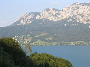
The Brennerin and the Attersee |
||
| height | 1602 m above sea level A. | |
| location | Upper Austria , Austria | |
| Mountains | Hell Mountains | |
| Dominance | 0.5 km → Salzberg | |
| Notch height | 35 m ↓ at mountain rescue hut | |
| Coordinates | 47 ° 49 '4 " N , 13 ° 34' 46" E | |
|
|
||
The burner is a 1602 m above sea level. A. high mountain in the Höllengebirge .
The name is said to come from the fact that the limestone plateau was burned down for grazing purposes.
South of the summit is a mountain rescue hut with an open emergency room. From the Attersee the rather little-visited summit can be reached via five marked paths: from Weißenbach over the Schoberstein and the subsequent long ridge crossing, over the normal route to the Hochleckenhaus past the Adlerspitzen , the very steep climbs over the Stieg and over the Brennerriese as well the Attersee via ferrata.

