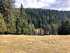
Buchrain (Ohlstadt)
| Buchrain | ||
|---|---|---|
|
Buchrain as seen from Wank |
||
| height | 1456 m | |
| location | Germany ( Bavaria ) | |
| Mountains | Ester Mountains | |
| Dominance | 0.18 km → Rauheck | |
| Notch height | 0.01 m | |
| Coordinates | 47 ° 36 '53 " N , 11 ° 14' 33" E | |
|
|
||
The Buchrain forms the western end of a mountain range that stretches from the same over Rauheck to Heimgarten in the east. The Buchrain itself rises north of the Wank above the Wankhütte . He can be reached from Ohlstadt.
Individual evidence
cards
- Compass sheet 7, Murnau / Kochel / Staffelsee, 1: 50,000. Or UK L 30 from the Bavarian State Surveying Office, Karwendel Mountains, 1: 50,000.
Web links
- Buchrain in the BayernAtlas
- Mountain tours in the Tölzer Voralpenland and in the Karwendel : Buchrain (1456m) harry.ilo.de/projekte
- alltrails.com

