Mali Ston Bay
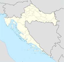
Coordinates: 42 ° 59 ′ 30 ″ N , 17 ° 25 ′ 0 ″ E
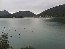
The bay of Mali Ston ( Croatian Malostonski zaljev or Malog Stona Canal ) is located between the mainland and the Pelješac peninsula and extends roughly from the end of the Neretva Delta to Mali Ston . The bay is 28 km long and a maximum of 6.1 km wide. The greatest depth is 29 m, but 80% of the bay is approximately 20 m deep.
In 1983 the bay was declared a special nature reserve. Because of the clean water, the largest oyster farms in the Adriatic were established here.
In the northwest, the bay can be crossed by the Trpanj - Ploce ferry . The construction of a bridge from the mainland to the peninsula to the southeast is planned and started. This Pelješac bridge is intended to create a road connection between southern Dalmatia with Dubrovnik and the rest of the Croatian national territory , which is interrupted by a short stretch of coast from Bosnia and Herzegovina near Neum .

